
EGMT Eagleton, Montana, USA - Earthquake Result Viewer
| ||||||||||||||||||
| ||||||||||||||||||
| ||||||||||||||||||
|
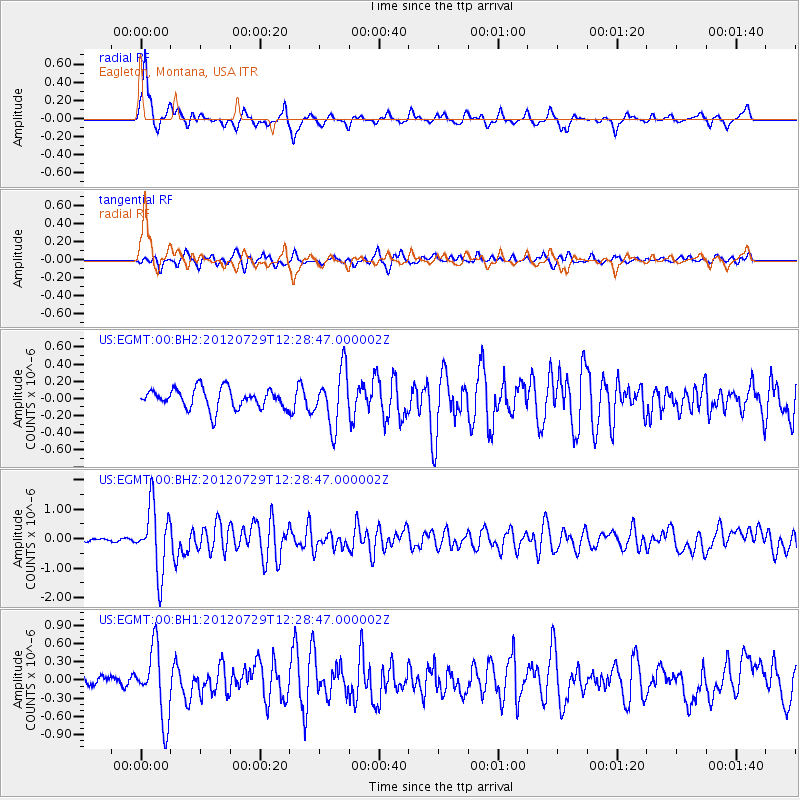
Signal To Noise
| Channel | StoN | STA | LTA |
| US:EGMT:00:BHZ:20120729T12:28:47.000002Z | 21.738544 | 1.1108735E-6 | 5.110156E-8 |
| US:EGMT:00:BH1:20120729T12:28:47.000002Z | 5.1947155 | 5.771795E-7 | 1.11108974E-7 |
| US:EGMT:00:BH2:20120729T12:28:47.000002Z | 2.7778678 | 3.1977098E-7 | 1.1511382E-7 |
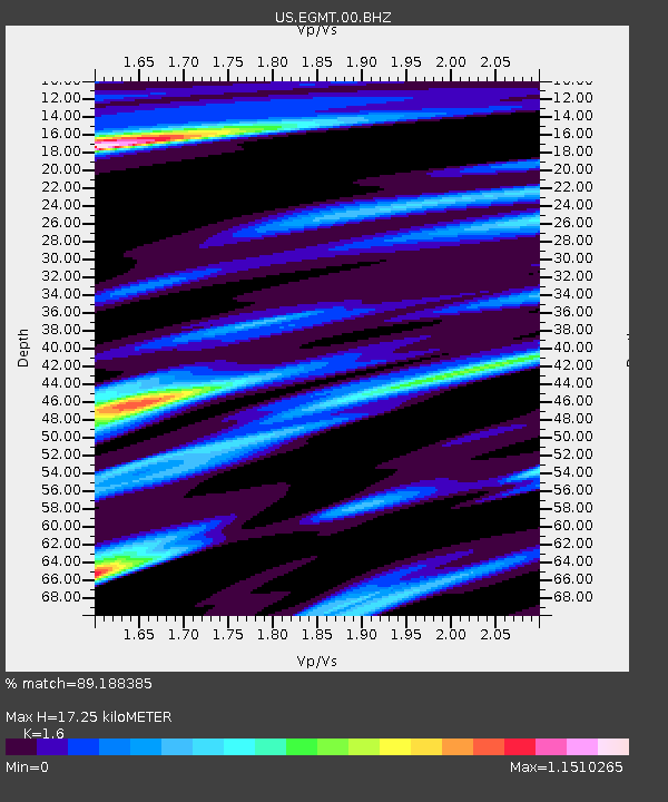
| Arrivals | |
| Ps | 1.7 SECOND |
| PpPs | 6.4 SECOND |
| PsPs/PpSs | 8.2 SECOND |

