You are here: Home > Network List > IU - Global Seismograph Network (GSN - IRIS/USGS) Stations List
> Station RSSD Black Hills, South Dakota, USA > Earthquake Result Viewer
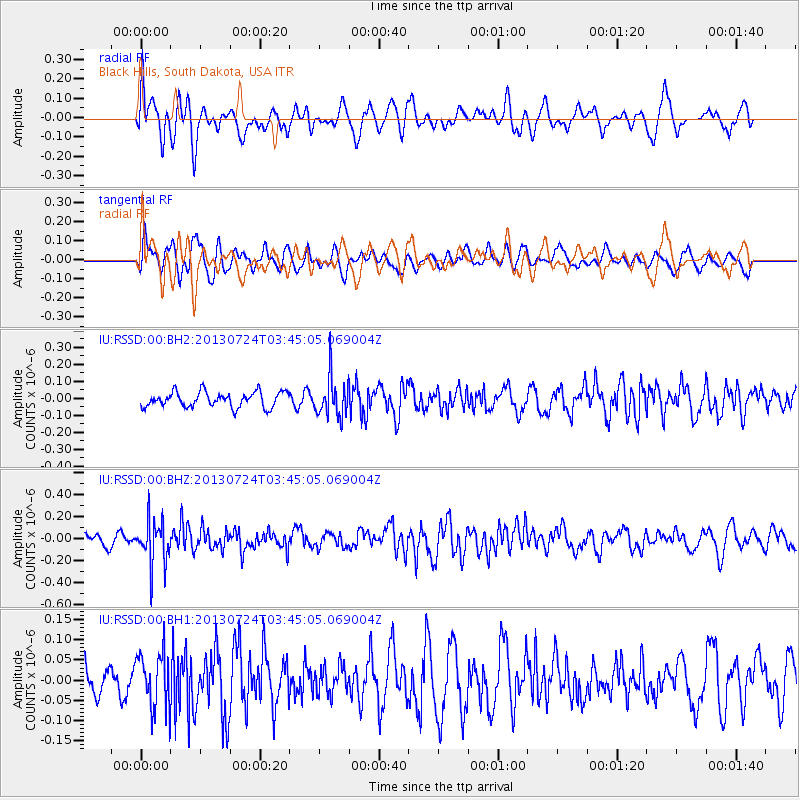
RSSD Black Hills, South Dakota, USA - Earthquake Result Viewer
*The percent match for this event was below the threshold and hence no stack was calculated.
| Earthquake location: |
South Of Fiji Islands |
| Earthquake latitude/longitude: |
-23.1/-177.2 |
| Earthquake time(UTC): |
2013/07/24 (205) 03:32:33 GMT |
| Earthquake Depth: |
156 km |
| Earthquake Magnitude: |
5.9 MW, 5.5 MB, 5.9 MW |
| Earthquake Catalog/Contributor: |
NEIC PDE/NEIC PDE-W |
|
| Network: |
IU Global Seismograph Network (GSN - IRIS/USGS) |
| Station: |
RSSD Black Hills, South Dakota, USA |
| Lat/Lon: |
44.12 N/104.04 W |
| Elevation: |
2090 m |
|
| Distance: |
94.5 deg |
| Az: |
43.756 deg |
| Baz: |
242.126 deg |
| Ray Param: |
$rayparam |
*The percent match for this event was below the threshold and hence was not used in the summary stack. |
|
| Radial Match: |
56.29289 % |
| Radial Bump: |
400 |
| Transverse Match: |
64.57829 % |
| Transverse Bump: |
400 |
| SOD ConfigId: |
589702 |
| Insert Time: |
2013-09-20 03:13:56.016 +0000 |
| GWidth: |
2.5 |
| Max Bumps: |
400 |
| Tol: |
0.001 |
|
Signal To Noise
| Channel | StoN | STA | LTA |
| IU:RSSD:00:BHZ:20130724T03:45:05.069004Z | 3.9759803 | 2.0063368E-7 | 5.0461434E-8 |
| IU:RSSD:00:BH1:20130724T03:45:05.069004Z | 1.6004094 | 6.9204745E-8 | 4.32419E-8 |
| IU:RSSD:00:BH2:20130724T03:45:05.069004Z | 2.5544727 | 1.1387106E-7 | 4.457713E-8 |
| Arrivals |
| Ps | |
| PpPs | |
| PsPs/PpSs | |


