You are here: Home > Network List > US - United States National Seismic Network Stations List
> Station AMTX Amarillo, Texas, USA > Earthquake Result Viewer
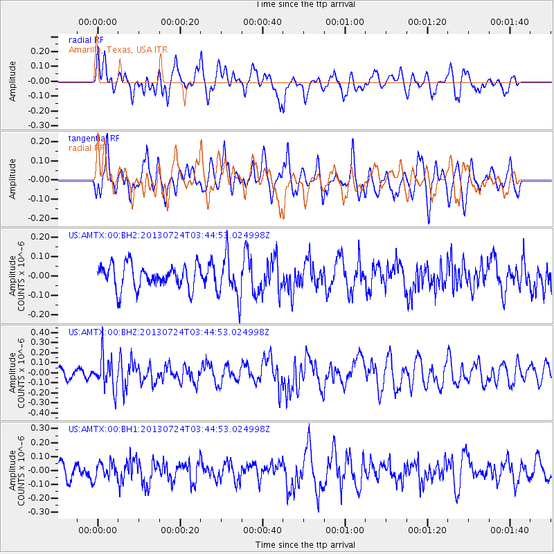
AMTX Amarillo, Texas, USA - Earthquake Result Viewer
*The percent match for this event was below the threshold and hence no stack was calculated.
| Earthquake location: |
South Of Fiji Islands |
| Earthquake latitude/longitude: |
-23.1/-177.2 |
| Earthquake time(UTC): |
2013/07/24 (205) 03:32:33 GMT |
| Earthquake Depth: |
156 km |
| Earthquake Magnitude: |
5.9 MW, 5.5 MB, 5.9 MW |
| Earthquake Catalog/Contributor: |
NEIC PDE/NEIC PDE-W |
|
| Network: |
US United States National Seismic Network |
| Station: |
AMTX Amarillo, Texas, USA |
| Lat/Lon: |
34.53 N/101.41 W |
| Elevation: |
1010 m |
|
| Distance: |
92.0 deg |
| Az: |
53.215 deg |
| Baz: |
243.252 deg |
| Ray Param: |
$rayparam |
*The percent match for this event was below the threshold and hence was not used in the summary stack. |
|
| Radial Match: |
66.37178 % |
| Radial Bump: |
400 |
| Transverse Match: |
52.176117 % |
| Transverse Bump: |
400 |
| SOD ConfigId: |
589702 |
| Insert Time: |
2013-09-20 03:19:06.843 +0000 |
| GWidth: |
2.5 |
| Max Bumps: |
400 |
| Tol: |
0.001 |
|
Signal To Noise
| Channel | StoN | STA | LTA |
| US:AMTX:00:BHZ:20130724T03:44:53.024998Z | 2.9966216 | 1.6556345E-7 | 5.5250034E-8 |
| US:AMTX:00:BH1:20130724T03:44:53.024998Z | 0.88510305 | 5.658045E-8 | 6.392527E-8 |
| US:AMTX:00:BH2:20130724T03:44:53.024998Z | 1.7934524 | 1.0970794E-7 | 6.117137E-8 |
| Arrivals |
| Ps | |
| PpPs | |
| PsPs/PpSs | |


