You are here: Home > Network List > TJ - Tajikistan National Seismic Network Stations List
> Station GARM Garm, Tajikistan > Earthquake Result Viewer
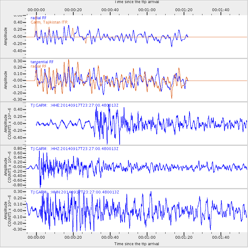
GARM Garm, Tajikistan - Earthquake Result Viewer
*The percent match for this event was below the threshold and hence no stack was calculated.
| Earthquake location: |
Southwestern Ryukyu Isl., Japan |
| Earthquake latitude/longitude: |
24.8/125.4 |
| Earthquake time(UTC): |
2014/09/17 (260) 23:18:55 GMT |
| Earthquake Depth: |
45 km |
| Earthquake Magnitude: |
5.0 MW |
| Earthquake Catalog/Contributor: |
ISC/ISC |
|
| Network: |
TJ Tajikistan National Seismic Network |
| Station: |
GARM Garm, Tajikistan |
| Lat/Lon: |
39.00 N/70.32 E |
| Elevation: |
1305 m |
|
| Distance: |
48.2 deg |
| Az: |
300.951 deg |
| Baz: |
90.038 deg |
| Ray Param: |
$rayparam |
*The percent match for this event was below the threshold and hence was not used in the summary stack. |
|
| Radial Match: |
55.95775 % |
| Radial Bump: |
360 |
| Transverse Match: |
57.68054 % |
| Transverse Bump: |
400 |
| SOD ConfigId: |
3390531 |
| Insert Time: |
2019-04-14 02:38:50.023 +0000 |
| GWidth: |
2.5 |
| Max Bumps: |
400 |
| Tol: |
0.001 |
|
Signal To Noise
| Channel | StoN | STA | LTA |
| TJ:GARM: :HHZ:20140917T23:27:00.480013Z | 3.3045075 | 3.262225E-7 | 9.872046E-8 |
| TJ:GARM: :HHN:20140917T23:27:00.480013Z | 1.4009756 | 9.728635E-8 | 6.944186E-8 |
| TJ:GARM: :HHE:20140917T23:27:00.480013Z | 3.639574 | 2.1029855E-7 | 5.7781087E-8 |
| Arrivals |
| Ps | |
| PpPs | |
| PsPs/PpSs | |


