You are here: Home > Network List > TA - USArray Transportable Network (new EarthScope stations) Stations List
> Station N02D Trinity Center, CA, USA > Earthquake Result Viewer
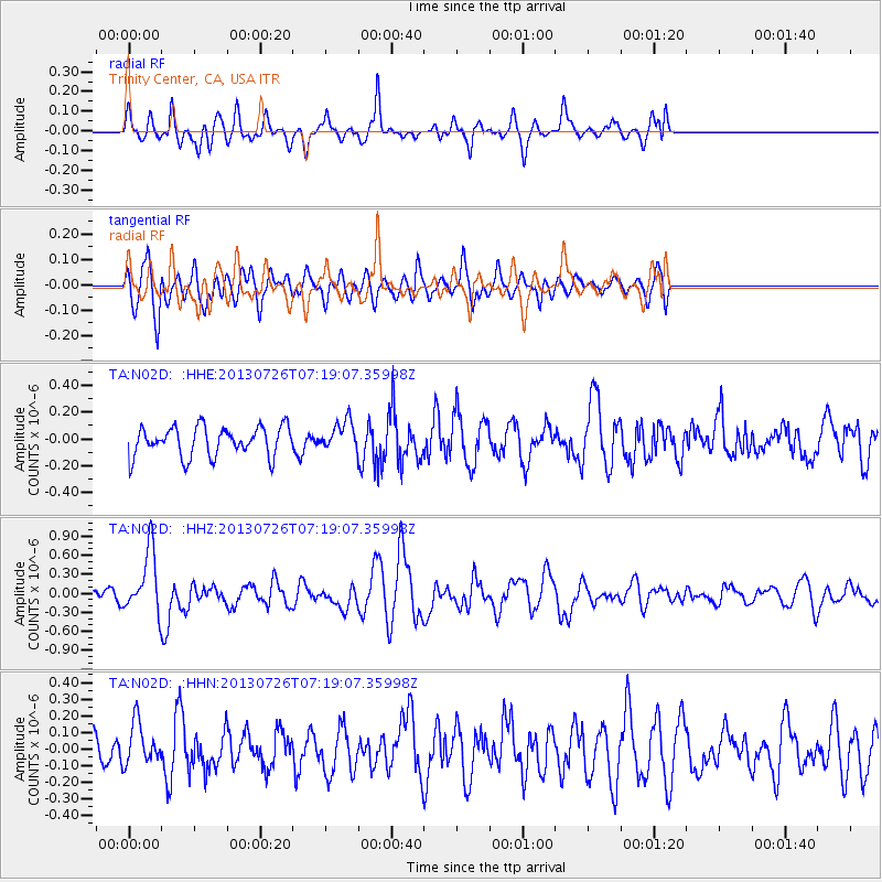
N02D Trinity Center, CA, USA - Earthquake Result Viewer
*The percent match for this event was below the threshold and hence no stack was calculated.
| Earthquake location: |
Vanuatu Islands |
| Earthquake latitude/longitude: |
-15.4/167.7 |
| Earthquake time(UTC): |
2013/07/26 (207) 07:07:15 GMT |
| Earthquake Depth: |
124 km |
| Earthquake Magnitude: |
6.1 MW, 6.1 MW |
| Earthquake Catalog/Contributor: |
NEIC PDE/NEIC PDE-W |
|
| Network: |
TA USArray Transportable Network (new EarthScope stations) |
| Station: |
N02D Trinity Center, CA, USA |
| Lat/Lon: |
40.97 N/122.71 W |
| Elevation: |
937 m |
|
| Distance: |
85.3 deg |
| Az: |
45.409 deg |
| Baz: |
245.13 deg |
| Ray Param: |
$rayparam |
*The percent match for this event was below the threshold and hence was not used in the summary stack. |
|
| Radial Match: |
67.22972 % |
| Radial Bump: |
400 |
| Transverse Match: |
57.345745 % |
| Transverse Bump: |
400 |
| SOD ConfigId: |
589702 |
| Insert Time: |
2013-09-20 03:38:14.375 +0000 |
| GWidth: |
2.5 |
| Max Bumps: |
400 |
| Tol: |
0.001 |
|
Signal To Noise
| Channel | StoN | STA | LTA |
| TA:N02D: :HHZ:20130726T07:19:07.35998Z | 4.223531 | 4.8758216E-7 | 1.15444216E-7 |
| TA:N02D: :HHN:20130726T07:19:07.35998Z | 1.201118 | 1.328745E-7 | 1.1062569E-7 |
| TA:N02D: :HHE:20130726T07:19:07.35998Z | 0.98003405 | 1.0889449E-7 | 1.1111297E-7 |
| Arrivals |
| Ps | |
| PpPs | |
| PsPs/PpSs | |


