You are here: Home > Network List > UW - Pacific Northwest Regional Seismic Network Stations List
> Station LCCR Mulino, OR, USA > Earthquake Result Viewer
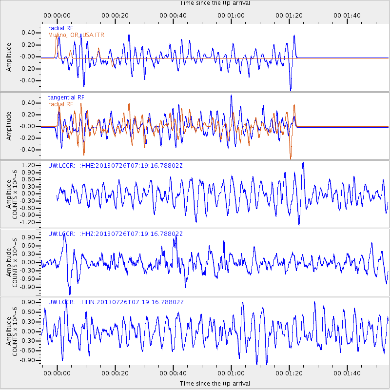
LCCR Mulino, OR, USA - Earthquake Result Viewer
*The percent match for this event was below the threshold and hence no stack was calculated.
| Earthquake location: |
Vanuatu Islands |
| Earthquake latitude/longitude: |
-15.4/167.7 |
| Earthquake time(UTC): |
2013/07/26 (207) 07:07:15 GMT |
| Earthquake Depth: |
124 km |
| Earthquake Magnitude: |
6.1 MW, 6.1 MW |
| Earthquake Catalog/Contributor: |
NEIC PDE/NEIC PDE-W |
|
| Network: |
UW Pacific Northwest Regional Seismic Network |
| Station: |
LCCR Mulino, OR, USA |
| Lat/Lon: |
45.21 N/122.48 W |
| Elevation: |
273 m |
|
| Distance: |
87.2 deg |
| Az: |
41.635 deg |
| Baz: |
245.037 deg |
| Ray Param: |
$rayparam |
*The percent match for this event was below the threshold and hence was not used in the summary stack. |
|
| Radial Match: |
63.04759 % |
| Radial Bump: |
400 |
| Transverse Match: |
51.19505 % |
| Transverse Bump: |
400 |
| SOD ConfigId: |
589702 |
| Insert Time: |
2013-09-20 03:41:02.545 +0000 |
| GWidth: |
2.5 |
| Max Bumps: |
400 |
| Tol: |
0.001 |
|
Signal To Noise
| Channel | StoN | STA | LTA |
| UW:LCCR: :HHZ:20130726T07:19:16.78802Z | 4.4644647 | 5.972957E-7 | 1.3378887E-7 |
| UW:LCCR: :HHN:20130726T07:19:16.78802Z | 1.9010329 | 4.795506E-7 | 2.522579E-7 |
| UW:LCCR: :HHE:20130726T07:19:16.78802Z | 1.3512881 | 3.7367695E-7 | 2.765339E-7 |
| Arrivals |
| Ps | |
| PpPs | |
| PsPs/PpSs | |


