
MPG Montagne des Peres, French Guyana - Earthquake Result Viewer
| ||||||||||||||||||
| ||||||||||||||||||
| ||||||||||||||||||
|
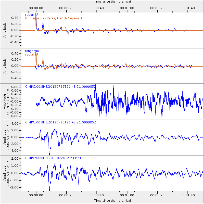
Signal To Noise
| Channel | StoN | STA | LTA |
| G:MPG:00:BHZ:20130726T21:43:21.099985Z | 5.559324 | 8.178634E-7 | 1.4711563E-7 |
| G:MPG:00:BHN:20130726T21:43:21.099985Z | 2.9028807 | 3.2800253E-7 | 1.1299208E-7 |
| G:MPG:00:BHE:20130726T21:43:21.099985Z | 1.8220133 | 2.453946E-7 | 1.3468322E-7 |
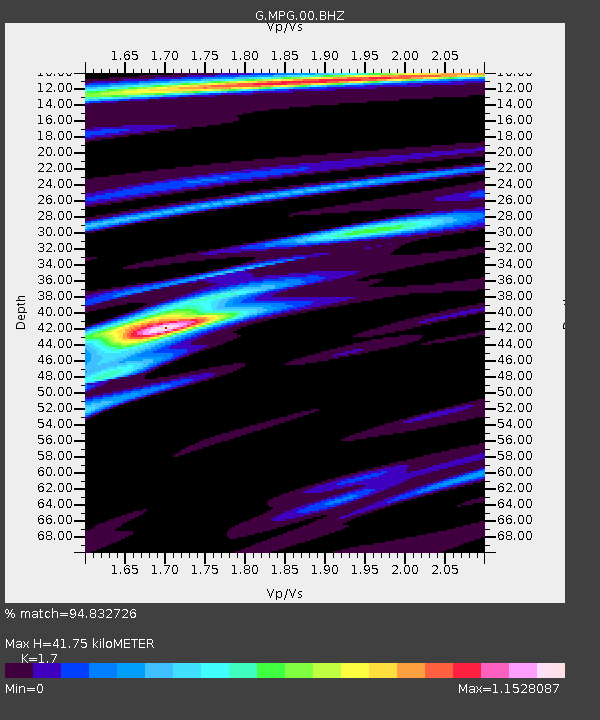
| Arrivals | |
| Ps | 4.7 SECOND |
| PpPs | 17 SECOND |
| PsPs/PpSs | 21 SECOND |

