You are here: Home > Network List > US - United States National Seismic Network Stations List
> Station LAO LASA Array, Montana, USA > Earthquake Result Viewer
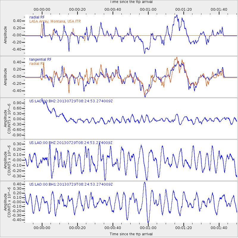
LAO LASA Array, Montana, USA - Earthquake Result Viewer
*The percent match for this event was below the threshold and hence no stack was calculated.
| Earthquake location: |
Fiji Islands Region |
| Earthquake latitude/longitude: |
-17.0/-177.1 |
| Earthquake time(UTC): |
2013/07/29 (210) 08:12:26 GMT |
| Earthquake Depth: |
9.9 km |
| Earthquake Magnitude: |
5.5 MW |
| Earthquake Catalog/Contributor: |
NEIC PDE/NEIC PDE-W |
|
| Network: |
US United States National Seismic Network |
| Station: |
LAO LASA Array, Montana, USA |
| Lat/Lon: |
46.69 N/106.22 W |
| Elevation: |
902 m |
|
| Distance: |
89.7 deg |
| Az: |
40.561 deg |
| Baz: |
244.684 deg |
| Ray Param: |
$rayparam |
*The percent match for this event was below the threshold and hence was not used in the summary stack. |
|
| Radial Match: |
44.77949 % |
| Radial Bump: |
400 |
| Transverse Match: |
35.64455 % |
| Transverse Bump: |
400 |
| SOD ConfigId: |
589702 |
| Insert Time: |
2013-09-20 04:01:30.632 +0000 |
| GWidth: |
2.5 |
| Max Bumps: |
400 |
| Tol: |
0.001 |
|
Signal To Noise
| Channel | StoN | STA | LTA |
| US:LAO:00:BHZ:20130729T08:24:53.274009Z | 1.5548259 | 9.919261E-8 | 6.3796605E-8 |
| US:LAO:00:BH1:20130729T08:24:53.274009Z | 0.8573086 | 1.3359697E-7 | 1.5583299E-7 |
| US:LAO:00:BH2:20130729T08:24:53.274009Z | 0.9140787 | 3.1940687E-7 | 3.4943037E-7 |
| Arrivals |
| Ps | |
| PpPs | |
| PsPs/PpSs | |


