You are here: Home > Network List > IU - Global Seismograph Network (GSN - IRIS/USGS) Stations List
> Station RSSD Black Hills, South Dakota, USA > Earthquake Result Viewer
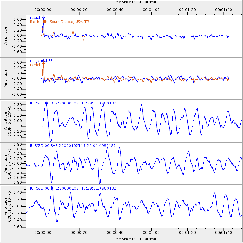
RSSD Black Hills, South Dakota, USA - Earthquake Result Viewer
*The percent match for this event was below the threshold and hence no stack was calculated.
| Earthquake location: |
Tonga Islands |
| Earthquake latitude/longitude: |
-20.8/-174.2 |
| Earthquake time(UTC): |
2000/01/02 (002) 15:16:32 GMT |
| Earthquake Depth: |
33 km |
| Earthquake Magnitude: |
5.5 MB, 5.8 MS, 5.8 MW, 5.8 MW |
| Earthquake Catalog/Contributor: |
WHDF/NEIC |
|
| Network: |
IU Global Seismograph Network (GSN - IRIS/USGS) |
| Station: |
RSSD Black Hills, South Dakota, USA |
| Lat/Lon: |
44.12 N/104.04 W |
| Elevation: |
2060 m |
|
| Distance: |
90.9 deg |
| Az: |
42.666 deg |
| Baz: |
241.713 deg |
| Ray Param: |
$rayparam |
*The percent match for this event was below the threshold and hence was not used in the summary stack. |
|
| Radial Match: |
75.40951 % |
| Radial Bump: |
350 |
| Transverse Match: |
44.560196 % |
| Transverse Bump: |
400 |
| SOD ConfigId: |
590571 |
| Insert Time: |
2013-09-24 16:56:22.481 +0000 |
| GWidth: |
2.5 |
| Max Bumps: |
400 |
| Tol: |
0.001 |
|
Signal To Noise
| Channel | StoN | STA | LTA |
| IU:RSSD:00:BHZ:20000102T15:29:01.498018Z | 3.684761 | 3.1881038E-7 | 8.652132E-8 |
| IU:RSSD:00:BH1:20000102T15:29:01.498018Z | 1.9229566 | 2.1923444E-7 | 1.1400905E-7 |
| IU:RSSD:00:BH2:20000102T15:29:01.498018Z | 1.2682848 | 1.9836665E-7 | 1.5640545E-7 |
| Arrivals |
| Ps | |
| PpPs | |
| PsPs/PpSs | |


