You are here: Home > Network List > KN - Kyrgyz Seismic Telemetry Network Stations List
> Station TKM2 - > Earthquake Result Viewer
TKM2 - - Earthquake Result Viewer
*The percent match for this event was below the threshold and hence no stack was calculated.
| Earthquake location: |
Northwest Of Kuril Islands |
| Earthquake latitude/longitude: |
50.6/150.2 |
| Earthquake time(UTC): |
2014/09/18 (261) 04:17:53 GMT |
| Earthquake Depth: |
502 km |
| Earthquake Magnitude: |
5.6 MW |
| Earthquake Catalog/Contributor: |
ISC/ISC |
|
| Network: |
KN Kyrgyz Seismic Telemetry Network |
| Station: |
TKM2 - |
| Lat/Lon: |
42.92 N/75.60 E |
| Elevation: |
2020 m |
|
| Distance: |
49.7 deg |
| Az: |
291.727 deg |
| Baz: |
53.745 deg |
| Ray Param: |
$rayparam |
*The percent match for this event was below the threshold and hence was not used in the summary stack. |
|
| Radial Match: |
79.96149 % |
| Radial Bump: |
400 |
| Transverse Match: |
70.69415 % |
| Transverse Bump: |
400 |
| SOD ConfigId: |
3390531 |
| Insert Time: |
2019-04-14 02:46:06.977 +0000 |
| GWidth: |
2.5 |
| Max Bumps: |
400 |
| Tol: |
0.001 |
|
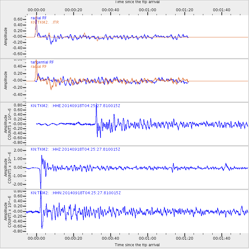
Signal To Noise
| Channel | StoN | STA | LTA |
| KN:TKM2: :HHZ:20140918T04:25:27.810015Z | 19.31962 | 7.548506E-7 | 3.907171E-8 |
| KN:TKM2: :HHN:20140918T04:25:27.810015Z | 9.58533 | 2.9000455E-7 | 3.025504E-8 |
| KN:TKM2: :HHE:20140918T04:25:27.810015Z | 10.690984 | 2.8346037E-7 | 2.6513964E-8 |
| Arrivals |
| Ps | |
| PpPs | |
| PsPs/PpSs | |


