You are here: Home > Network List > IU - Global Seismograph Network (GSN - IRIS/USGS) Stations List
> Station RSSD Black Hills, South Dakota, USA > Earthquake Result Viewer
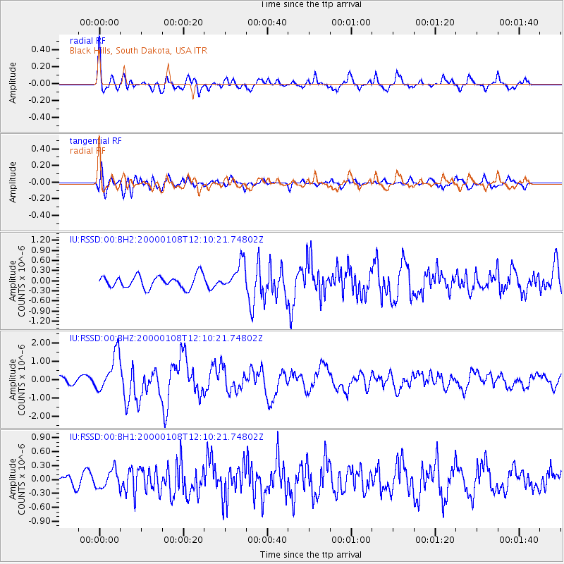
RSSD Black Hills, South Dakota, USA - Earthquake Result Viewer
*The percent match for this event was below the threshold and hence no stack was calculated.
| Earthquake location: |
Near Coast Of Northern Chile |
| Earthquake latitude/longitude: |
-23.2/-70.1 |
| Earthquake time(UTC): |
2000/01/08 (008) 11:59:21 GMT |
| Earthquake Depth: |
36 km |
| Earthquake Magnitude: |
5.8 MB, 5.9 MS, 6.4 MW, 6.1 ME |
| Earthquake Catalog/Contributor: |
WHDF/NEIC |
|
| Network: |
IU Global Seismograph Network (GSN - IRIS/USGS) |
| Station: |
RSSD Black Hills, South Dakota, USA |
| Lat/Lon: |
44.12 N/104.04 W |
| Elevation: |
2060 m |
|
| Distance: |
73.8 deg |
| Az: |
335.266 deg |
| Baz: |
147.679 deg |
| Ray Param: |
$rayparam |
*The percent match for this event was below the threshold and hence was not used in the summary stack. |
|
| Radial Match: |
72.57295 % |
| Radial Bump: |
400 |
| Transverse Match: |
64.5165 % |
| Transverse Bump: |
400 |
| SOD ConfigId: |
590571 |
| Insert Time: |
2013-09-24 17:10:51.111 +0000 |
| GWidth: |
2.5 |
| Max Bumps: |
400 |
| Tol: |
0.001 |
|
Signal To Noise
| Channel | StoN | STA | LTA |
| IU:RSSD:00:BHZ:20000108T12:10:21.74802Z | 4.543085 | 1.0550744E-6 | 2.3223744E-7 |
| IU:RSSD:00:BH1:20000108T12:10:21.74802Z | 1.7670788 | 1.9592832E-7 | 1.1087696E-7 |
| IU:RSSD:00:BH2:20000108T12:10:21.74802Z | 2.2251086 | 4.1720932E-7 | 1.8750065E-7 |
| Arrivals |
| Ps | |
| PpPs | |
| PsPs/PpSs | |


