You are here: Home > Network List > IU - Global Seismograph Network (GSN - IRIS/USGS) Stations List
> Station RSSD Black Hills, South Dakota, USA > Earthquake Result Viewer
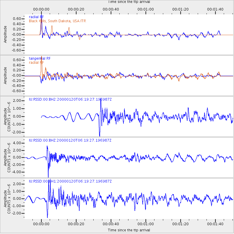
RSSD Black Hills, South Dakota, USA - Earthquake Result Viewer
*The percent match for this event was below the threshold and hence no stack was calculated.
| Earthquake location: |
Alaska Peninsula |
| Earthquake latitude/longitude: |
56.6/-161.9 |
| Earthquake time(UTC): |
2000/01/20 (020) 06:13:02 GMT |
| Earthquake Depth: |
221 km |
| Earthquake Magnitude: |
5.7 MB, 5.9 MW, 5.8 MW |
| Earthquake Catalog/Contributor: |
WHDF/NEIC |
|
| Network: |
IU Global Seismograph Network (GSN - IRIS/USGS) |
| Station: |
RSSD Black Hills, South Dakota, USA |
| Lat/Lon: |
44.12 N/104.04 W |
| Elevation: |
2060 m |
|
| Distance: |
37.8 deg |
| Az: |
84.009 deg |
| Baz: |
310.239 deg |
| Ray Param: |
$rayparam |
*The percent match for this event was below the threshold and hence was not used in the summary stack. |
|
| Radial Match: |
75.26403 % |
| Radial Bump: |
400 |
| Transverse Match: |
68.1101 % |
| Transverse Bump: |
400 |
| SOD ConfigId: |
590571 |
| Insert Time: |
2013-09-24 17:14:23.205 +0000 |
| GWidth: |
2.5 |
| Max Bumps: |
400 |
| Tol: |
0.001 |
|
Signal To Noise
| Channel | StoN | STA | LTA |
| IU:RSSD:00:BHZ:20000120T06:19:27.196987Z | 5.4632845 | 1.5417185E-6 | 2.8219628E-7 |
| IU:RSSD:00:BH1:20000120T06:19:27.196987Z | 3.356002 | 8.6914395E-7 | 2.5898194E-7 |
| IU:RSSD:00:BH2:20000120T06:19:27.196987Z | 3.7604194 | 9.4055565E-7 | 2.5011988E-7 |
| Arrivals |
| Ps | |
| PpPs | |
| PsPs/PpSs | |


