You are here: Home > Network List > IU - Global Seismograph Network (GSN - IRIS/USGS) Stations List
> Station JOHN Johnston Island, USA > Earthquake Result Viewer
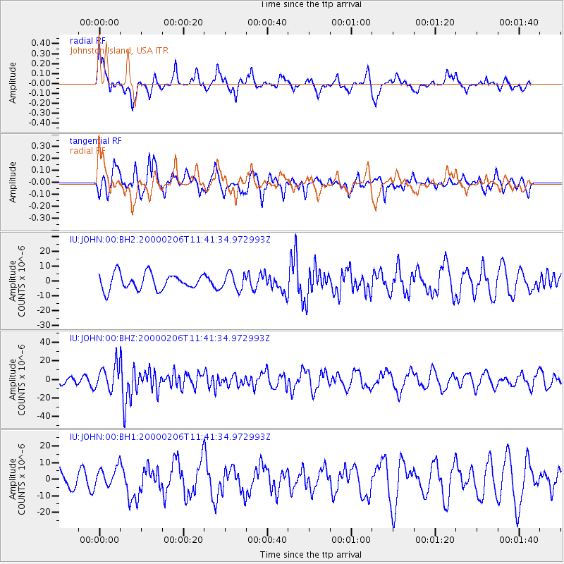
JOHN Johnston Island, USA - Earthquake Result Viewer
*The percent match for this event was below the threshold and hence no stack was calculated.
| Earthquake location: |
New Britain Region, P.N.G. |
| Earthquake latitude/longitude: |
-5.8/150.9 |
| Earthquake time(UTC): |
2000/02/06 (037) 11:33:52 GMT |
| Earthquake Depth: |
33 km |
| Earthquake Magnitude: |
6.6 MB, 6.8 MS, 6.6 MW, 6.3 ME |
| Earthquake Catalog/Contributor: |
WHDF/NEIC |
|
| Network: |
IU Global Seismograph Network (GSN - IRIS/USGS) |
| Station: |
JOHN Johnston Island, USA |
| Lat/Lon: |
16.73 N/169.53 W |
| Elevation: |
2.0 m |
|
| Distance: |
45.1 deg |
| Az: |
59.526 deg |
| Baz: |
243.49 deg |
| Ray Param: |
$rayparam |
*The percent match for this event was below the threshold and hence was not used in the summary stack. |
|
| Radial Match: |
49.680847 % |
| Radial Bump: |
348 |
| Transverse Match: |
62.466045 % |
| Transverse Bump: |
400 |
| SOD ConfigId: |
590571 |
| Insert Time: |
2013-09-24 17:19:10.437 +0000 |
| GWidth: |
2.5 |
| Max Bumps: |
400 |
| Tol: |
0.001 |
|
Signal To Noise
| Channel | StoN | STA | LTA |
| IU:JOHN:00:BHZ:20000206T11:41:34.972993Z | 3.9255464 | 1.3712802E-5 | 3.4932211E-6 |
| IU:JOHN:00:BH1:20000206T11:41:34.972993Z | 1.0801466 | 6.220662E-6 | 5.7590905E-6 |
| IU:JOHN:00:BH2:20000206T11:41:34.972993Z | 1.0150882 | 5.452841E-6 | 5.37179E-6 |
| Arrivals |
| Ps | |
| PpPs | |
| PsPs/PpSs | |


