You are here: Home > Network List > IU - Global Seismograph Network (GSN - IRIS/USGS) Stations List
> Station JOHN Johnston Island, USA > Earthquake Result Viewer
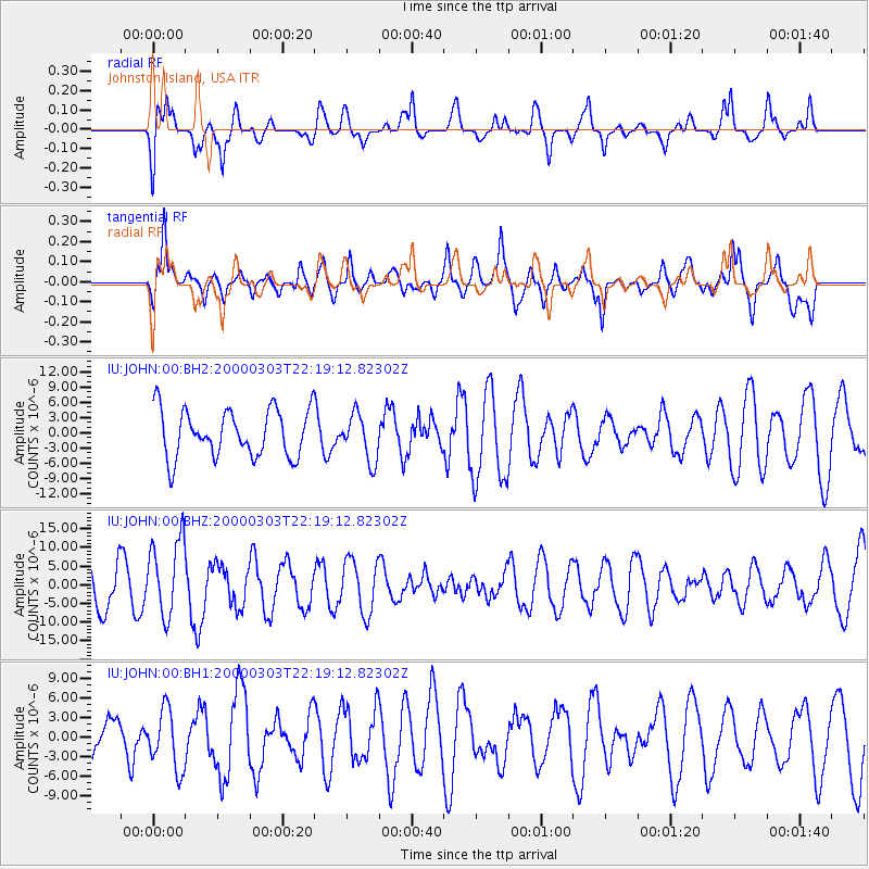
JOHN Johnston Island, USA - Earthquake Result Viewer
*The percent match for this event was below the threshold and hence no stack was calculated.
| Earthquake location: |
Banda Sea |
| Earthquake latitude/longitude: |
-7.3/128.5 |
| Earthquake time(UTC): |
2000/03/03 (063) 22:09:13 GMT |
| Earthquake Depth: |
142 km |
| Earthquake Magnitude: |
6.4 MB, 5.8 MS, 6.3 MW, 6.3 MW |
| Earthquake Catalog/Contributor: |
WHDF/NEIC |
|
| Network: |
IU Global Seismograph Network (GSN - IRIS/USGS) |
| Station: |
JOHN Johnston Island, USA |
| Lat/Lon: |
16.73 N/169.53 W |
| Elevation: |
2.0 m |
|
| Distance: |
65.8 deg |
| Az: |
68.054 deg |
| Baz: |
253.786 deg |
| Ray Param: |
$rayparam |
*The percent match for this event was below the threshold and hence was not used in the summary stack. |
|
| Radial Match: |
53.4008 % |
| Radial Bump: |
400 |
| Transverse Match: |
53.009132 % |
| Transverse Bump: |
400 |
| SOD ConfigId: |
590571 |
| Insert Time: |
2013-09-24 17:25:53.149 +0000 |
| GWidth: |
2.5 |
| Max Bumps: |
400 |
| Tol: |
0.001 |
|
Signal To Noise
| Channel | StoN | STA | LTA |
| IU:JOHN:00:BHZ:20000303T22:19:12.82302Z | 2.073927 | 1.04480605E-5 | 5.037815E-6 |
| IU:JOHN:00:BH1:20000303T22:19:12.82302Z | 0.68008655 | 4.5843726E-6 | 6.7408664E-6 |
| IU:JOHN:00:BH2:20000303T22:19:12.82302Z | 0.9814924 | 4.588224E-6 | 4.6747423E-6 |
| Arrivals |
| Ps | |
| PpPs | |
| PsPs/PpSs | |


