You are here: Home > Network List > IU - Global Seismograph Network (GSN - IRIS/USGS) Stations List
> Station POHA Pohakuloa, Hawaii, USA > Earthquake Result Viewer
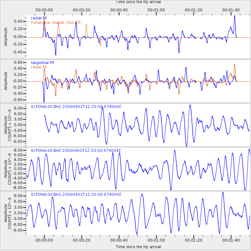
POHA Pohakuloa, Hawaii, USA - Earthquake Result Viewer
*The percent match for this event was below the threshold and hence no stack was calculated.
| Earthquake location: |
Fiji Islands Region |
| Earthquake latitude/longitude: |
-17.8/-178.8 |
| Earthquake time(UTC): |
2000/04/01 (092) 12:13:24 GMT |
| Earthquake Depth: |
556 km |
| Earthquake Magnitude: |
5.7 MW, 5.6 MW |
| Earthquake Catalog/Contributor: |
NEIC PDE/NEIC PDE-M |
|
| Network: |
IU Global Seismograph Network (GSN - IRIS/USGS) |
| Station: |
POHA Pohakuloa, Hawaii, USA |
| Lat/Lon: |
19.76 N/155.53 W |
| Elevation: |
1967 m |
|
| Distance: |
43.7 deg |
| Az: |
32.515 deg |
| Baz: |
212.947 deg |
| Ray Param: |
$rayparam |
*The percent match for this event was below the threshold and hence was not used in the summary stack. |
|
| Radial Match: |
50.698956 % |
| Radial Bump: |
393 |
| Transverse Match: |
56.131794 % |
| Transverse Bump: |
345 |
| SOD ConfigId: |
590571 |
| Insert Time: |
2013-09-24 18:05:50.559 +0000 |
| GWidth: |
2.5 |
| Max Bumps: |
400 |
| Tol: |
0.001 |
|
Signal To Noise
| Channel | StoN | STA | LTA |
| IU:POHA:00:BHZ:20000401T12:20:09.674004Z | 2.0725377 | 4.5364727E-6 | 2.1888493E-6 |
| IU:POHA:00:BH1:20000401T12:20:09.674004Z | 1.1438254 | 4.3536706E-6 | 3.806237E-6 |
| IU:POHA:00:BH2:20000401T12:20:09.674004Z | 3.0551558 | 6.462383E-6 | 2.1152387E-6 |
| Arrivals |
| Ps | |
| PpPs | |
| PsPs/PpSs | |


