You are here: Home > Network List > II - Global Seismograph Network (GSN - IRIS/IDA) Stations List
> Station MBAR Mbarara, Uganda > Earthquake Result Viewer
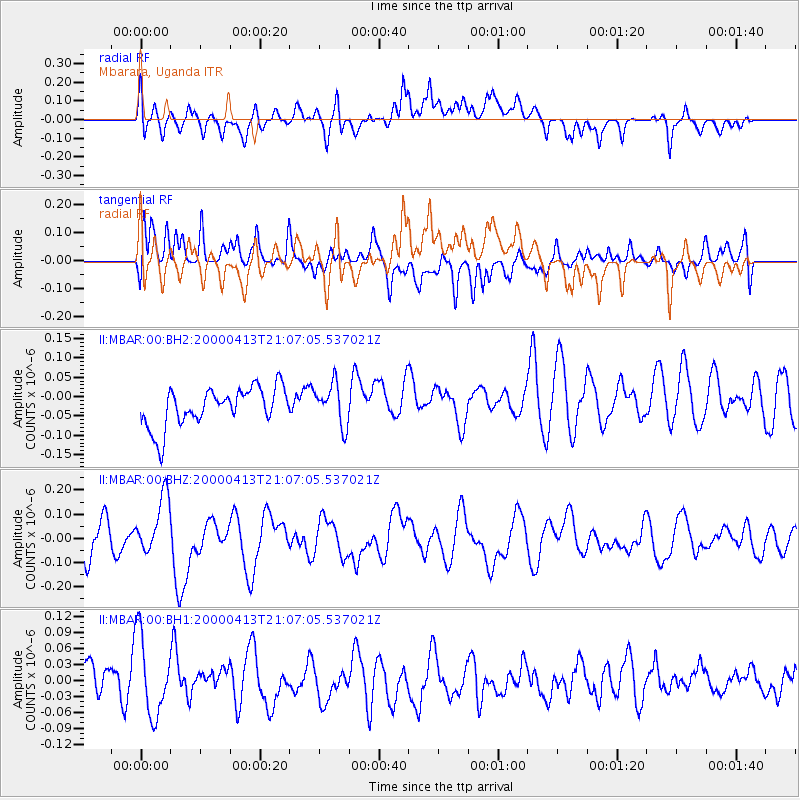
MBAR Mbarara, Uganda - Earthquake Result Viewer
*The percent match for this event was below the threshold and hence no stack was calculated.
| Earthquake location: |
Philippine Islands Region |
| Earthquake latitude/longitude: |
10.3/126.5 |
| Earthquake time(UTC): |
2000/04/13 (104) 20:54:14 GMT |
| Earthquake Depth: |
33 km |
| Earthquake Magnitude: |
5.9 MW, 5.6 MB, 5.8 MS, 6.0 ME |
| Earthquake Catalog/Contributor: |
NEIC PDE/NEIC PDE-M |
|
| Network: |
II Global Seismograph Network (GSN - IRIS/IDA) |
| Station: |
MBAR Mbarara, Uganda |
| Lat/Lon: |
0.60 S/30.74 E |
| Elevation: |
1390 m |
|
| Distance: |
95.8 deg |
| Az: |
270.44 deg |
| Baz: |
79.774 deg |
| Ray Param: |
$rayparam |
*The percent match for this event was below the threshold and hence was not used in the summary stack. |
|
| Radial Match: |
48.82853 % |
| Radial Bump: |
400 |
| Transverse Match: |
48.139374 % |
| Transverse Bump: |
400 |
| SOD ConfigId: |
590571 |
| Insert Time: |
2013-09-24 18:07:58.383 +0000 |
| GWidth: |
2.5 |
| Max Bumps: |
400 |
| Tol: |
0.001 |
|
Signal To Noise
| Channel | StoN | STA | LTA |
| II:MBAR:00:BHZ:20000413T21:07:05.537021Z | 1.9843191 | 1.1890451E-7 | 5.992207E-8 |
| II:MBAR:00:BH1:20000413T21:07:05.537021Z | 1.6154037 | 7.813526E-8 | 4.8368875E-8 |
| II:MBAR:00:BH2:20000413T21:07:05.537021Z | 1.0689912 | 5.367493E-8 | 5.021083E-8 |
| Arrivals |
| Ps | |
| PpPs | |
| PsPs/PpSs | |


