You are here: Home > Network List > TA - USArray Transportable Network (new EarthScope stations) Stations List
> Station A21K Barrow, AK, USA > Earthquake Result Viewer
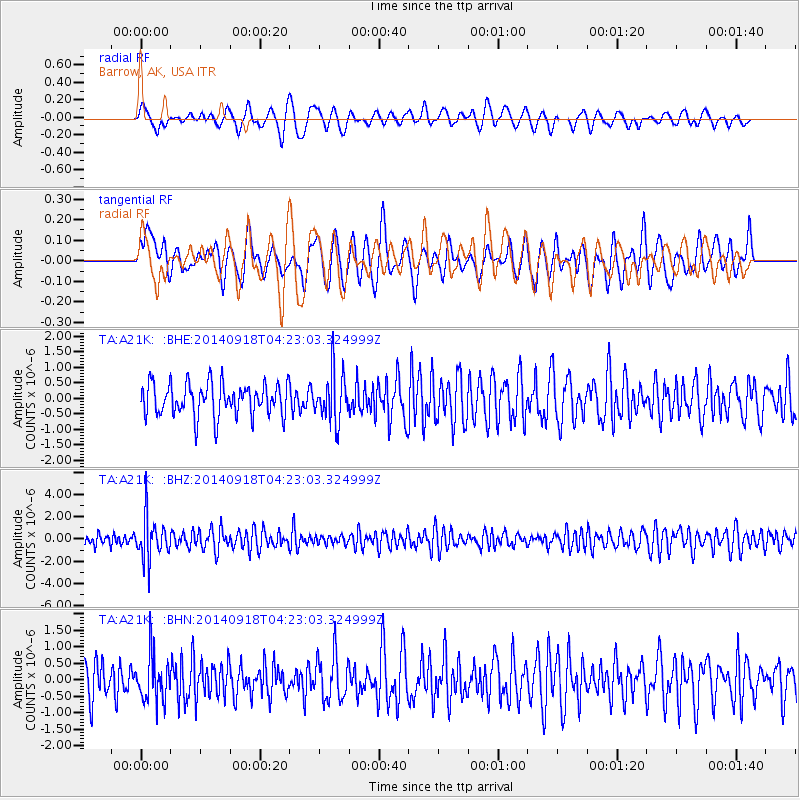
A21K Barrow, AK, USA - Earthquake Result Viewer
*The percent match for this event was below the threshold and hence no stack was calculated.
| Earthquake location: |
Northwest Of Kuril Islands |
| Earthquake latitude/longitude: |
50.6/150.2 |
| Earthquake time(UTC): |
2014/09/18 (261) 04:17:53 GMT |
| Earthquake Depth: |
502 km |
| Earthquake Magnitude: |
5.6 MW |
| Earthquake Catalog/Contributor: |
ISC/ISC |
|
| Network: |
TA USArray Transportable Network (new EarthScope stations) |
| Station: |
A21K Barrow, AK, USA |
| Lat/Lon: |
71.32 N/156.62 W |
| Elevation: |
577 m |
|
| Distance: |
31.5 deg |
| Az: |
29.555 deg |
| Baz: |
257.485 deg |
| Ray Param: |
$rayparam |
*The percent match for this event was below the threshold and hence was not used in the summary stack. |
|
| Radial Match: |
60.29426 % |
| Radial Bump: |
400 |
| Transverse Match: |
48.22752 % |
| Transverse Bump: |
400 |
| SOD ConfigId: |
3390531 |
| Insert Time: |
2019-04-14 02:49:08.823 +0000 |
| GWidth: |
2.5 |
| Max Bumps: |
400 |
| Tol: |
0.001 |
|
Signal To Noise
| Channel | StoN | STA | LTA |
| TA:A21K: :BHZ:20140918T04:23:03.324999Z | 2.2661953 | 1.8456582E-6 | 8.1443034E-7 |
| TA:A21K: :BHN:20140918T04:23:03.324999Z | 1.2895243 | 7.1094195E-7 | 5.513211E-7 |
| TA:A21K: :BHE:20140918T04:23:03.324999Z | 1.4830035 | 7.84156E-7 | 5.287621E-7 |
| Arrivals |
| Ps | |
| PpPs | |
| PsPs/PpSs | |


