You are here: Home > Network List > IU - Global Seismograph Network (GSN - IRIS/USGS) Stations List
> Station POHA Pohakuloa, Hawaii, USA > Earthquake Result Viewer
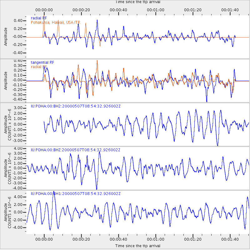
POHA Pohakuloa, Hawaii, USA - Earthquake Result Viewer
*The percent match for this event was below the threshold and hence no stack was calculated.
| Earthquake location: |
Tonga Islands |
| Earthquake latitude/longitude: |
-15.2/-173.6 |
| Earthquake time(UTC): |
2000/05/07 (128) 08:47:39 GMT |
| Earthquake Depth: |
33 km |
| Earthquake Magnitude: |
5.7 MW, 5.5 MS, 5.7 MW |
| Earthquake Catalog/Contributor: |
NEIC PDE/NEIC PDE-M |
|
| Network: |
IU Global Seismograph Network (GSN - IRIS/USGS) |
| Station: |
POHA Pohakuloa, Hawaii, USA |
| Lat/Lon: |
19.76 N/155.53 W |
| Elevation: |
1967 m |
|
| Distance: |
39.1 deg |
| Az: |
27.646 deg |
| Baz: |
208.397 deg |
| Ray Param: |
$rayparam |
*The percent match for this event was below the threshold and hence was not used in the summary stack. |
|
| Radial Match: |
52.387283 % |
| Radial Bump: |
387 |
| Transverse Match: |
61.8817 % |
| Transverse Bump: |
400 |
| SOD ConfigId: |
590571 |
| Insert Time: |
2013-09-24 18:14:40.697 +0000 |
| GWidth: |
2.5 |
| Max Bumps: |
400 |
| Tol: |
0.001 |
|
Signal To Noise
| Channel | StoN | STA | LTA |
| IU:POHA:00:BHZ:20000507T08:54:32.926002Z | 0.5644857 | 4.946746E-7 | 8.7632793E-7 |
| IU:POHA:00:BH1:20000507T08:54:32.926002Z | 2.0803282 | 2.6434486E-6 | 1.2706884E-6 |
| IU:POHA:00:BH2:20000507T08:54:32.926002Z | 0.55776167 | 4.35651E-7 | 7.810701E-7 |
| Arrivals |
| Ps | |
| PpPs | |
| PsPs/PpSs | |


