You are here: Home > Network List > TA - USArray Transportable Network (new EarthScope stations) Stations List
> Station N54A Moraine State Park, Portersville, PA, USA > Earthquake Result Viewer
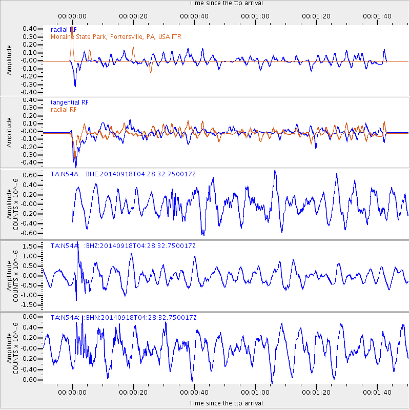
N54A Moraine State Park, Portersville, PA, USA - Earthquake Result Viewer
*The percent match for this event was below the threshold and hence no stack was calculated.
| Earthquake location: |
Northwest Of Kuril Islands |
| Earthquake latitude/longitude: |
50.6/150.2 |
| Earthquake time(UTC): |
2014/09/18 (261) 04:17:53 GMT |
| Earthquake Depth: |
502 km |
| Earthquake Magnitude: |
5.6 MW |
| Earthquake Catalog/Contributor: |
ISC/ISC |
|
| Network: |
TA USArray Transportable Network (new EarthScope stations) |
| Station: |
N54A Moraine State Park, Portersville, PA, USA |
| Lat/Lon: |
40.96 N/79.99 W |
| Elevation: |
408 m |
|
| Distance: |
78.8 deg |
| Az: |
36.353 deg |
| Baz: |
330.06 deg |
| Ray Param: |
$rayparam |
*The percent match for this event was below the threshold and hence was not used in the summary stack. |
|
| Radial Match: |
64.5 % |
| Radial Bump: |
400 |
| Transverse Match: |
74.117035 % |
| Transverse Bump: |
400 |
| SOD ConfigId: |
3390531 |
| Insert Time: |
2019-04-14 02:49:49.292 +0000 |
| GWidth: |
2.5 |
| Max Bumps: |
400 |
| Tol: |
0.001 |
|
Signal To Noise
| Channel | StoN | STA | LTA |
| TA:N54A: :BHZ:20140918T04:28:32.750017Z | 2.355333 | 6.229699E-7 | 2.6449334E-7 |
| TA:N54A: :BHN:20140918T04:28:32.750017Z | 1.3194777 | 2.5139406E-7 | 1.9052544E-7 |
| TA:N54A: :BHE:20140918T04:28:32.750017Z | 0.75260663 | 1.6087756E-7 | 2.137605E-7 |
| Arrivals |
| Ps | |
| PpPs | |
| PsPs/PpSs | |


