MBAR Mbarara, Uganda - Earthquake Result Viewer
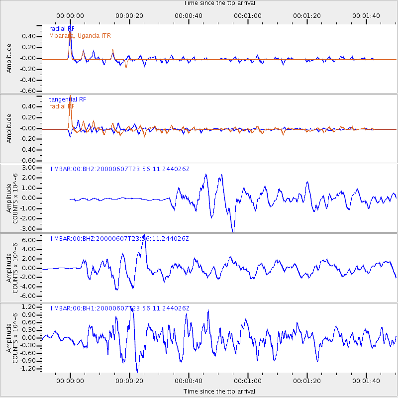
Earthquake location: Southern Sumatra, Indonesia
Earthquake latitude/longitude: -4.6/101.9
Earthquake time(UTC): 2000/06/07 (159) 23:45:26 GMT
Earthquake Depth: 33 km
Earthquake Magnitude: 6.1 MB, 6.7 MS, 6.7 MW, 6.5 MW
Earthquake Catalog/Contributor: WHDF/NEIC
Network: II Global Seismograph Network (GSN - IRIS/IDA)
Station: MBAR Mbarara, Uganda
Lat/Lon: 0.60 S/30.74 E
Elevation: 1390 m
Distance: 71.2 deg
Az: 270.931 deg
Baz: 94.636 deg
Ray Param: 0.054448742
Estimated Moho Depth: 53.0 km
Estimated Crust Vp/Vs: 1.91
Assumed Crust Vp: 6.419 km/s
Estimated Crust Vs: 3.352 km/s
Estimated Crust Poisson's Ratio: 0.31
Radial Match: 96.28161 %
Radial Bump: 358
Transverse Match: 88.16355 %
Transverse Bump: 400
SOD ConfigId: 590571
Insert Time: 2013-09-24 18:23:22.216 +0000
GWidth: 2.5
Max Bumps: 400
Tol: 0.001

Signal To Noise

ChannelStoNSTALTA
II:MBAR:00:BHZ:20000607T23:56:11.244026Z8.8298296.138566E-76.952078E-8
II:MBAR:00:BH1:20000607T23:56:11.244026Z1.61594921.5891362E-79.834073E-8
II:MBAR:00:BH2:20000607T23:56:11.244026Z3.64085462.6782058E-77.355981E-8
Arrivals
Ps7.8 SECOND
PpPs23 SECOND
PsPs/PpSs31 SECOND