You are here: Home > Network List > TA - USArray Transportable Network (new EarthScope stations) Stations List
> Station Q53A Leroy, WV, USA > Earthquake Result Viewer
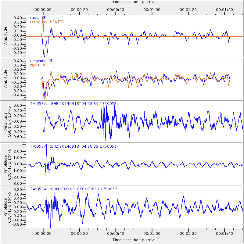
Q53A Leroy, WV, USA - Earthquake Result Viewer
*The percent match for this event was below the threshold and hence no stack was calculated.
| Earthquake location: |
Northwest Of Kuril Islands |
| Earthquake latitude/longitude: |
50.6/150.2 |
| Earthquake time(UTC): |
2014/09/18 (261) 04:17:53 GMT |
| Earthquake Depth: |
502 km |
| Earthquake Magnitude: |
5.6 MW |
| Earthquake Catalog/Contributor: |
ISC/ISC |
|
| Network: |
TA USArray Transportable Network (new EarthScope stations) |
| Station: |
Q53A Leroy, WV, USA |
| Lat/Lon: |
38.86 N/81.53 W |
| Elevation: |
310 m |
|
| Distance: |
80.1 deg |
| Az: |
38.467 deg |
| Baz: |
329.466 deg |
| Ray Param: |
$rayparam |
*The percent match for this event was below the threshold and hence was not used in the summary stack. |
|
| Radial Match: |
64.032364 % |
| Radial Bump: |
400 |
| Transverse Match: |
71.82598 % |
| Transverse Bump: |
400 |
| SOD ConfigId: |
3390531 |
| Insert Time: |
2019-04-14 02:50:01.226 +0000 |
| GWidth: |
2.5 |
| Max Bumps: |
400 |
| Tol: |
0.001 |
|
Signal To Noise
| Channel | StoN | STA | LTA |
| TA:Q53A: :BHZ:20140918T04:28:39.175005Z | 3.523569 | 8.3396003E-7 | 2.3668048E-7 |
| TA:Q53A: :BHN:20140918T04:28:39.175005Z | 1.6109616 | 3.0532178E-7 | 1.8952767E-7 |
| TA:Q53A: :BHE:20140918T04:28:39.175005Z | 1.4885927 | 3.002603E-7 | 2.017075E-7 |
| Arrivals |
| Ps | |
| PpPs | |
| PsPs/PpSs | |


