You are here: Home > Network List > TA - USArray Transportable Network (new EarthScope stations) Stations List
> Station R59A King George, VA, USA > Earthquake Result Viewer
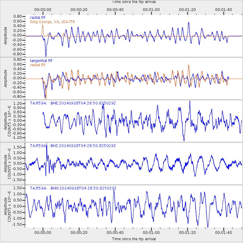
R59A King George, VA, USA - Earthquake Result Viewer
*The percent match for this event was below the threshold and hence no stack was calculated.
| Earthquake location: |
Northwest Of Kuril Islands |
| Earthquake latitude/longitude: |
50.6/150.2 |
| Earthquake time(UTC): |
2014/09/18 (261) 04:17:53 GMT |
| Earthquake Depth: |
502 km |
| Earthquake Magnitude: |
5.6 MW |
| Earthquake Catalog/Contributor: |
ISC/ISC |
|
| Network: |
TA USArray Transportable Network (new EarthScope stations) |
| Station: |
R59A King George, VA, USA |
| Lat/Lon: |
38.20 N/77.12 W |
| Elevation: |
35 m |
|
| Distance: |
82.3 deg |
| Az: |
35.744 deg |
| Baz: |
331.784 deg |
| Ray Param: |
$rayparam |
*The percent match for this event was below the threshold and hence was not used in the summary stack. |
|
| Radial Match: |
56.05375 % |
| Radial Bump: |
400 |
| Transverse Match: |
69.463394 % |
| Transverse Bump: |
400 |
| SOD ConfigId: |
3390531 |
| Insert Time: |
2019-04-14 02:50:06.811 +0000 |
| GWidth: |
2.5 |
| Max Bumps: |
400 |
| Tol: |
0.001 |
|
Signal To Noise
| Channel | StoN | STA | LTA |
| TA:R59A: :BHZ:20140918T04:28:50.825029Z | 1.739257 | 5.878876E-7 | 3.3801078E-7 |
| TA:R59A: :BHN:20140918T04:28:50.825029Z | 0.93976873 | 4.6180745E-7 | 4.9140544E-7 |
| TA:R59A: :BHE:20140918T04:28:50.825029Z | 1.6542162 | 6.1539424E-7 | 3.7201562E-7 |
| Arrivals |
| Ps | |
| PpPs | |
| PsPs/PpSs | |


