You are here: Home > Network List > IU - Global Seismograph Network (GSN - IRIS/USGS) Stations List
> Station POHA Pohakuloa, Hawaii, USA > Earthquake Result Viewer
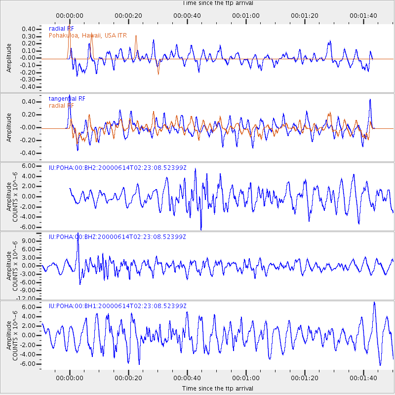
POHA Pohakuloa, Hawaii, USA - Earthquake Result Viewer
*The percent match for this event was below the threshold and hence no stack was calculated.
| Earthquake location: |
South Of Fiji Islands |
| Earthquake latitude/longitude: |
-25.5/178.0 |
| Earthquake time(UTC): |
2000/06/14 (166) 02:15:25 GMT |
| Earthquake Depth: |
605 km |
| Earthquake Magnitude: |
5.9 MB, 6.4 MW, 6.4 MW |
| Earthquake Catalog/Contributor: |
WHDF/NEIC |
|
| Network: |
IU Global Seismograph Network (GSN - IRIS/USGS) |
| Station: |
POHA Pohakuloa, Hawaii, USA |
| Lat/Lon: |
19.76 N/155.53 W |
| Elevation: |
1967 m |
|
| Distance: |
51.8 deg |
| Az: |
32.221 deg |
| Baz: |
210.765 deg |
| Ray Param: |
$rayparam |
*The percent match for this event was below the threshold and hence was not used in the summary stack. |
|
| Radial Match: |
54.598984 % |
| Radial Bump: |
400 |
| Transverse Match: |
58.44511 % |
| Transverse Bump: |
400 |
| SOD ConfigId: |
590571 |
| Insert Time: |
2013-09-24 18:26:22.230 +0000 |
| GWidth: |
2.5 |
| Max Bumps: |
400 |
| Tol: |
0.001 |
|
Signal To Noise
| Channel | StoN | STA | LTA |
| IU:POHA:00:BHZ:20000614T02:23:08.52399Z | 4.4414005 | 4.011431E-6 | 9.031906E-7 |
| IU:POHA:00:BH1:20000614T02:23:08.52399Z | 1.3764255 | 1.989936E-6 | 1.4457274E-6 |
| IU:POHA:00:BH2:20000614T02:23:08.52399Z | 2.0387094 | 2.1242106E-6 | 1.041939E-6 |
| Arrivals |
| Ps | |
| PpPs | |
| PsPs/PpSs | |


