You are here: Home > Network List > TA - USArray Transportable Network (new EarthScope stations) Stations List
> Station S60A Water View, VA, USA > Earthquake Result Viewer
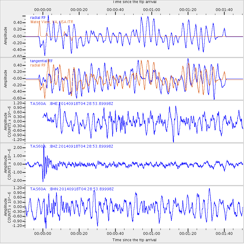
S60A Water View, VA, USA - Earthquake Result Viewer
*The percent match for this event was below the threshold and hence no stack was calculated.
| Earthquake location: |
Northwest Of Kuril Islands |
| Earthquake latitude/longitude: |
50.6/150.2 |
| Earthquake time(UTC): |
2014/09/18 (261) 04:17:53 GMT |
| Earthquake Depth: |
502 km |
| Earthquake Magnitude: |
5.6 MW |
| Earthquake Catalog/Contributor: |
ISC/ISC |
|
| Network: |
TA USArray Transportable Network (new EarthScope stations) |
| Station: |
S60A Water View, VA, USA |
| Lat/Lon: |
37.42 N/76.39 W |
| Elevation: |
36 m |
|
| Distance: |
83.3 deg |
| Az: |
35.601 deg |
| Baz: |
332.209 deg |
| Ray Param: |
$rayparam |
*The percent match for this event was below the threshold and hence was not used in the summary stack. |
|
| Radial Match: |
48.484566 % |
| Radial Bump: |
400 |
| Transverse Match: |
48.911865 % |
| Transverse Bump: |
400 |
| SOD ConfigId: |
3390531 |
| Insert Time: |
2019-04-14 02:50:10.443 +0000 |
| GWidth: |
2.5 |
| Max Bumps: |
400 |
| Tol: |
0.001 |
|
Signal To Noise
| Channel | StoN | STA | LTA |
| TA:S60A: :BHZ:20140918T04:28:53.89998Z | 5.0704126 | 9.02448E-7 | 1.7798315E-7 |
| TA:S60A: :BHN:20140918T04:28:53.89998Z | 1.2543837 | 5.697987E-7 | 4.5424594E-7 |
| TA:S60A: :BHE:20140918T04:28:53.89998Z | 1.1344768 | 4.657417E-7 | 4.1053434E-7 |
| Arrivals |
| Ps | |
| PpPs | |
| PsPs/PpSs | |


