You are here: Home > Network List > TA - USArray Transportable Network (new EarthScope stations) Stations List
> Station W57A Gilead, NC, USA > Earthquake Result Viewer
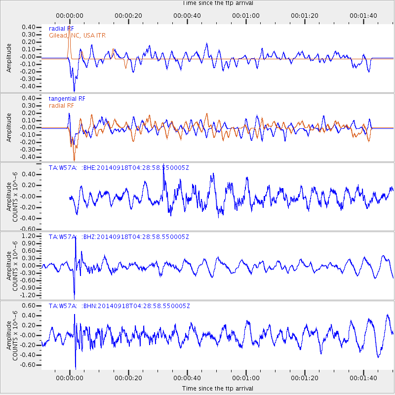
W57A Gilead, NC, USA - Earthquake Result Viewer
*The percent match for this event was below the threshold and hence no stack was calculated.
| Earthquake location: |
Northwest Of Kuril Islands |
| Earthquake latitude/longitude: |
50.6/150.2 |
| Earthquake time(UTC): |
2014/09/18 (261) 04:17:53 GMT |
| Earthquake Depth: |
502 km |
| Earthquake Magnitude: |
5.6 MW |
| Earthquake Catalog/Contributor: |
ISC/ISC |
|
| Network: |
TA USArray Transportable Network (new EarthScope stations) |
| Station: |
W57A Gilead, NC, USA |
| Lat/Lon: |
35.15 N/79.99 W |
| Elevation: |
85 m |
|
| Distance: |
83.9 deg |
| Az: |
39.263 deg |
| Baz: |
330.496 deg |
| Ray Param: |
$rayparam |
*The percent match for this event was below the threshold and hence was not used in the summary stack. |
|
| Radial Match: |
64.068 % |
| Radial Bump: |
400 |
| Transverse Match: |
53.920155 % |
| Transverse Bump: |
400 |
| SOD ConfigId: |
3390531 |
| Insert Time: |
2019-04-14 02:50:27.309 +0000 |
| GWidth: |
2.5 |
| Max Bumps: |
400 |
| Tol: |
0.001 |
|
Signal To Noise
| Channel | StoN | STA | LTA |
| TA:W57A: :BHZ:20140918T04:28:58.550005Z | 3.0980213 | 4.0368255E-7 | 1.3030335E-7 |
| TA:W57A: :BHN:20140918T04:28:58.550005Z | 1.4449612 | 1.9482874E-7 | 1.348332E-7 |
| TA:W57A: :BHE:20140918T04:28:58.550005Z | 1.9593515 | 1.9532956E-7 | 9.969092E-8 |
| Arrivals |
| Ps | |
| PpPs | |
| PsPs/PpSs | |


