You are here: Home > Network List > TA - USArray Transportable Network (new EarthScope stations) Stations List
> Station X43A Marvell, AR, USA > Earthquake Result Viewer
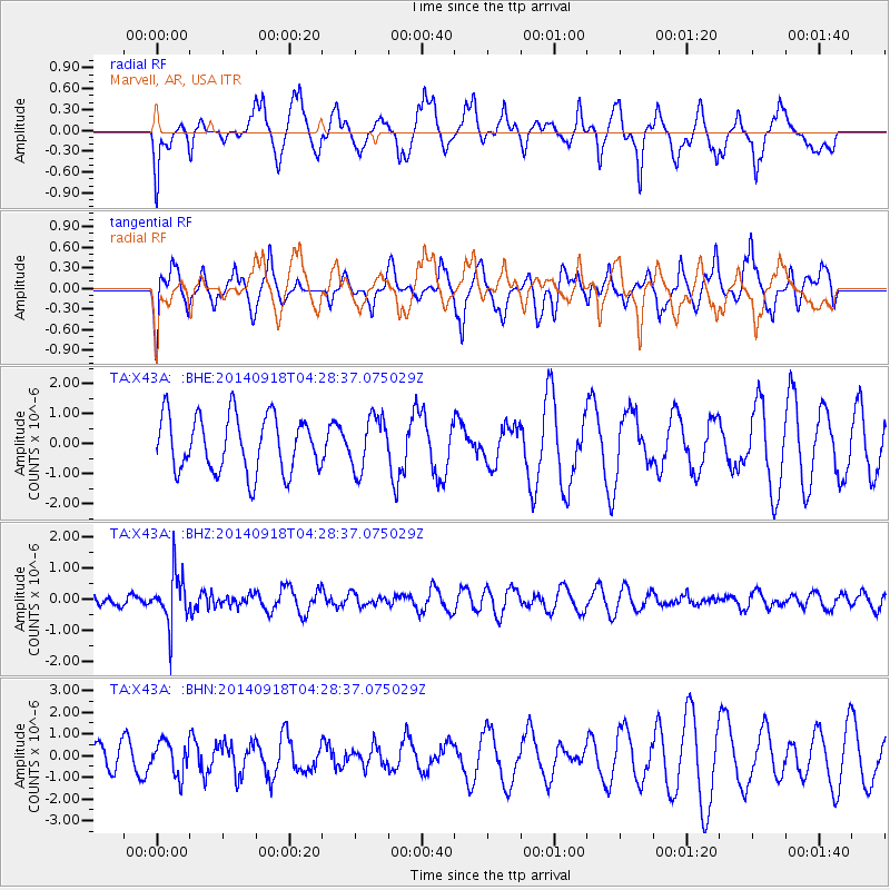
X43A Marvell, AR, USA - Earthquake Result Viewer
*The percent match for this event was below the threshold and hence no stack was calculated.
| Earthquake location: |
Northwest Of Kuril Islands |
| Earthquake latitude/longitude: |
50.6/150.2 |
| Earthquake time(UTC): |
2014/09/18 (261) 04:17:53 GMT |
| Earthquake Depth: |
502 km |
| Earthquake Magnitude: |
5.6 MW |
| Earthquake Catalog/Contributor: |
ISC/ISC |
|
| Network: |
TA USArray Transportable Network (new EarthScope stations) |
| Station: |
X43A Marvell, AR, USA |
| Lat/Lon: |
34.52 N/90.88 W |
| Elevation: |
53 m |
|
| Distance: |
79.6 deg |
| Az: |
47.268 deg |
| Baz: |
325.442 deg |
| Ray Param: |
$rayparam |
*The percent match for this event was below the threshold and hence was not used in the summary stack. |
|
| Radial Match: |
49.53845 % |
| Radial Bump: |
400 |
| Transverse Match: |
56.866245 % |
| Transverse Bump: |
400 |
| SOD ConfigId: |
3390531 |
| Insert Time: |
2019-04-14 02:50:30.954 +0000 |
| GWidth: |
2.5 |
| Max Bumps: |
400 |
| Tol: |
0.001 |
|
Signal To Noise
| Channel | StoN | STA | LTA |
| TA:X43A: :BHZ:20140918T04:28:37.075029Z | 2.67126 | 8.1650745E-7 | 3.056638E-7 |
| TA:X43A: :BHN:20140918T04:28:37.075029Z | 0.6689142 | 7.734537E-7 | 1.1562823E-6 |
| TA:X43A: :BHE:20140918T04:28:37.075029Z | 0.9474669 | 8.798803E-7 | 9.28666E-7 |
| Arrivals |
| Ps | |
| PpPs | |
| PsPs/PpSs | |


