You are here: Home > Network List > IU - Global Seismograph Network (GSN - IRIS/USGS) Stations List
> Station POHA Pohakuloa, Hawaii, USA > Earthquake Result Viewer
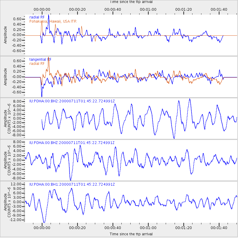
POHA Pohakuloa, Hawaii, USA - Earthquake Result Viewer
*The percent match for this event was below the threshold and hence no stack was calculated.
| Earthquake location: |
Kodiak Island Region, Alaska |
| Earthquake latitude/longitude: |
57.4/-154.3 |
| Earthquake time(UTC): |
2000/07/11 (193) 01:38:44 GMT |
| Earthquake Depth: |
67 km |
| Earthquake Magnitude: |
5.5 MB, 5.5 ML, 5.6 ML |
| Earthquake Catalog/Contributor: |
NEIC PDE/NEIC PDE-M |
|
| Network: |
IU Global Seismograph Network (GSN - IRIS/USGS) |
| Station: |
POHA Pohakuloa, Hawaii, USA |
| Lat/Lon: |
19.76 N/155.53 W |
| Elevation: |
1967 m |
|
| Distance: |
37.6 deg |
| Az: |
181.951 deg |
| Baz: |
1.121 deg |
| Ray Param: |
$rayparam |
*The percent match for this event was below the threshold and hence was not used in the summary stack. |
|
| Radial Match: |
58.469078 % |
| Radial Bump: |
400 |
| Transverse Match: |
42.581646 % |
| Transverse Bump: |
400 |
| SOD ConfigId: |
590571 |
| Insert Time: |
2013-09-24 18:36:01.001 +0000 |
| GWidth: |
2.5 |
| Max Bumps: |
400 |
| Tol: |
0.001 |
|
Signal To Noise
| Channel | StoN | STA | LTA |
| IU:POHA:00:BHZ:20000711T01:45:22.724991Z | 0.9048229 | 1.8876252E-6 | 2.086182E-6 |
| IU:POHA:00:BH1:20000711T01:45:22.724991Z | 2.442659 | 8.452397E-6 | 3.4603263E-6 |
| IU:POHA:00:BH2:20000711T01:45:22.724991Z | 1.3172774 | 3.5372532E-6 | 2.6852758E-6 |
| Arrivals |
| Ps | |
| PpPs | |
| PsPs/PpSs | |


