You are here: Home > Network List > IU - Global Seismograph Network (GSN - IRIS/USGS) Stations List
> Station JOHN Johnston Island, USA > Earthquake Result Viewer
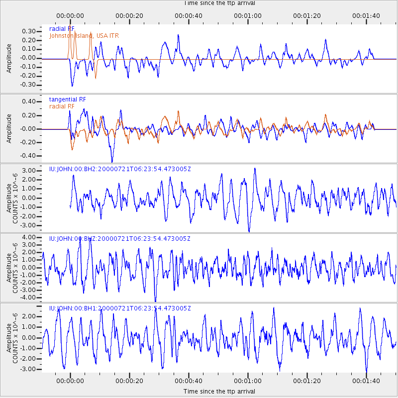
JOHN Johnston Island, USA - Earthquake Result Viewer
*The percent match for this event was below the threshold and hence no stack was calculated.
| Earthquake location: |
Central Mexico |
| Earthquake latitude/longitude: |
18.4/-98.9 |
| Earthquake time(UTC): |
2000/07/21 (203) 06:13:41 GMT |
| Earthquake Depth: |
80 km |
| Earthquake Magnitude: |
5.4 MB, 5.1 MS, 5.9 MW, 4.8 MD |
| Earthquake Catalog/Contributor: |
WHDF/NEIC |
|
| Network: |
IU Global Seismograph Network (GSN - IRIS/USGS) |
| Station: |
JOHN Johnston Island, USA |
| Lat/Lon: |
16.73 N/169.53 W |
| Elevation: |
2.0 m |
|
| Distance: |
66.9 deg |
| Az: |
280.763 deg |
| Baz: |
76.763 deg |
| Ray Param: |
$rayparam |
*The percent match for this event was below the threshold and hence was not used in the summary stack. |
|
| Radial Match: |
54.35966 % |
| Radial Bump: |
400 |
| Transverse Match: |
64.78881 % |
| Transverse Bump: |
400 |
| SOD ConfigId: |
590571 |
| Insert Time: |
2013-09-24 18:41:08.982 +0000 |
| GWidth: |
2.5 |
| Max Bumps: |
400 |
| Tol: |
0.001 |
|
Signal To Noise
| Channel | StoN | STA | LTA |
| IU:JOHN:00:BHZ:20000721T06:23:54.473005Z | 2.3012023 | 2.102378E-6 | 9.135998E-7 |
| IU:JOHN:00:BH1:20000721T06:23:54.473005Z | 1.6766143 | 1.3487005E-6 | 8.044191E-7 |
| IU:JOHN:00:BH2:20000721T06:23:54.473005Z | 1.5699157 | 1.4017651E-6 | 8.9289193E-7 |
| Arrivals |
| Ps | |
| PpPs | |
| PsPs/PpSs | |


