You are here: Home > Network List > US - United States National Seismic Network Stations List
> Station LAO LASA Array, Montana, USA > Earthquake Result Viewer
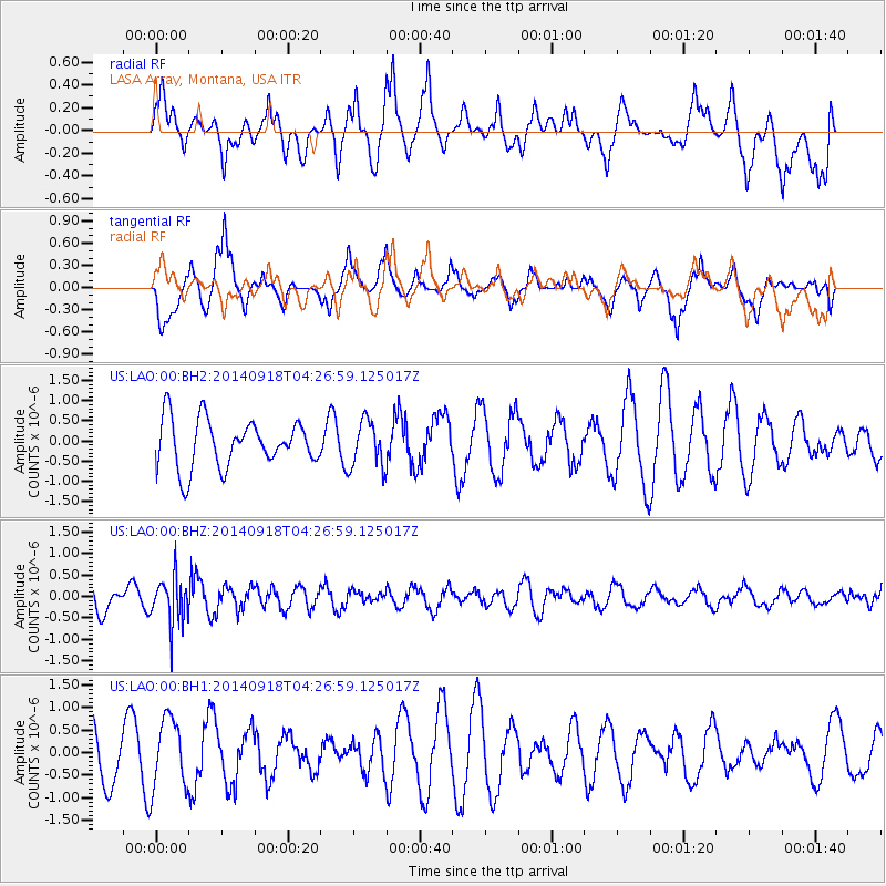
LAO LASA Array, Montana, USA - Earthquake Result Viewer
*The percent match for this event was below the threshold and hence no stack was calculated.
| Earthquake location: |
Northwest Of Kuril Islands |
| Earthquake latitude/longitude: |
50.6/150.2 |
| Earthquake time(UTC): |
2014/09/18 (261) 04:17:53 GMT |
| Earthquake Depth: |
502 km |
| Earthquake Magnitude: |
5.6 MW |
| Earthquake Catalog/Contributor: |
ISC/ISC |
|
| Network: |
US United States National Seismic Network |
| Station: |
LAO LASA Array, Montana, USA |
| Lat/Lon: |
46.69 N/106.22 W |
| Elevation: |
902 m |
|
| Distance: |
62.9 deg |
| Az: |
48.728 deg |
| Baz: |
315.878 deg |
| Ray Param: |
$rayparam |
*The percent match for this event was below the threshold and hence was not used in the summary stack. |
|
| Radial Match: |
54.91342 % |
| Radial Bump: |
400 |
| Transverse Match: |
55.30415 % |
| Transverse Bump: |
400 |
| SOD ConfigId: |
3390531 |
| Insert Time: |
2019-04-14 02:51:14.867 +0000 |
| GWidth: |
2.5 |
| Max Bumps: |
400 |
| Tol: |
0.001 |
|
Signal To Noise
| Channel | StoN | STA | LTA |
| US:LAO:00:BHZ:20140918T04:26:59.125017Z | 2.2823484 | 5.5701526E-7 | 2.4405355E-7 |
| US:LAO:00:BH1:20140918T04:26:59.125017Z | 0.83134043 | 7.791039E-7 | 9.371659E-7 |
| US:LAO:00:BH2:20140918T04:26:59.125017Z | 0.9830756 | 5.8170224E-7 | 5.917167E-7 |
| Arrivals |
| Ps | |
| PpPs | |
| PsPs/PpSs | |


