You are here: Home > Network List > IU - Global Seismograph Network (GSN - IRIS/USGS) Stations List
> Station POHA Pohakuloa, Hawaii, USA > Earthquake Result Viewer
POHA Pohakuloa, Hawaii, USA - Earthquake Result Viewer

| Earthquake location: |
Bonin Islands, Japan Region |
| Earthquake latitude/longitude: |
28.9/139.6 |
| Earthquake time(UTC): |
2000/08/06 (219) 07:27:12 GMT |
| Earthquake Depth: |
395 km |
| Earthquake Magnitude: |
6.3 MB, 7.3 MW, 7.3 MW |
| Earthquake Catalog/Contributor: |
WHDF/NEIC |
|
| Network: |
IU Global Seismograph Network (GSN - IRIS/USGS) |
| Station: |
POHA Pohakuloa, Hawaii, USA |
| Lat/Lon: |
19.76 N/155.53 W |
| Elevation: |
1967 m |
|
| Distance: |
59.2 deg |
| Az: |
83.113 deg |
| Baz: |
292.386 deg |
| Ray Param: |
0.060889557 |
| Estimated Moho Depth: |
11.5 km |
| Estimated Crust Vp/Vs: |
2.06 |
| Assumed Crust Vp: |
5.195 km/s |
| Estimated Crust Vs: |
2.525 km/s |
| Estimated Crust Poisson's Ratio: |
0.35 |
|
| Radial Match: |
83.584175 % |
| Radial Bump: |
400 |
| Transverse Match: |
77.06701 % |
| Transverse Bump: |
400 |
| SOD ConfigId: |
590571 |
| Insert Time: |
2013-09-24 18:48:54.025 +0000 |
| GWidth: |
2.5 |
| Max Bumps: |
400 |
| Tol: |
0.001 |
|
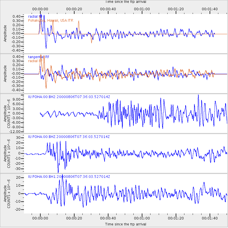
Signal To Noise
| Channel | StoN | STA | LTA |
| IU:POHA:00:BHZ:20000806T07:36:03.527014Z | 12.252051 | 5.7816346E-6 | 4.7189113E-7 |
| IU:POHA:00:BH1:20000806T07:36:03.527014Z | 1.7200844 | 2.2422664E-6 | 1.3035793E-6 |
| IU:POHA:00:BH2:20000806T07:36:03.527014Z | 1.1037992 | 1.0774959E-6 | 9.761702E-7 |
| Arrivals |
| Ps | 2.4 SECOND |
| PpPs | 6.6 SECOND |
| PsPs/PpSs | 9.0 SECOND |


