You are here: Home > Network List > IU - Global Seismograph Network (GSN - IRIS/USGS) Stations List
> Station RSSD Black Hills, South Dakota, USA > Earthquake Result Viewer
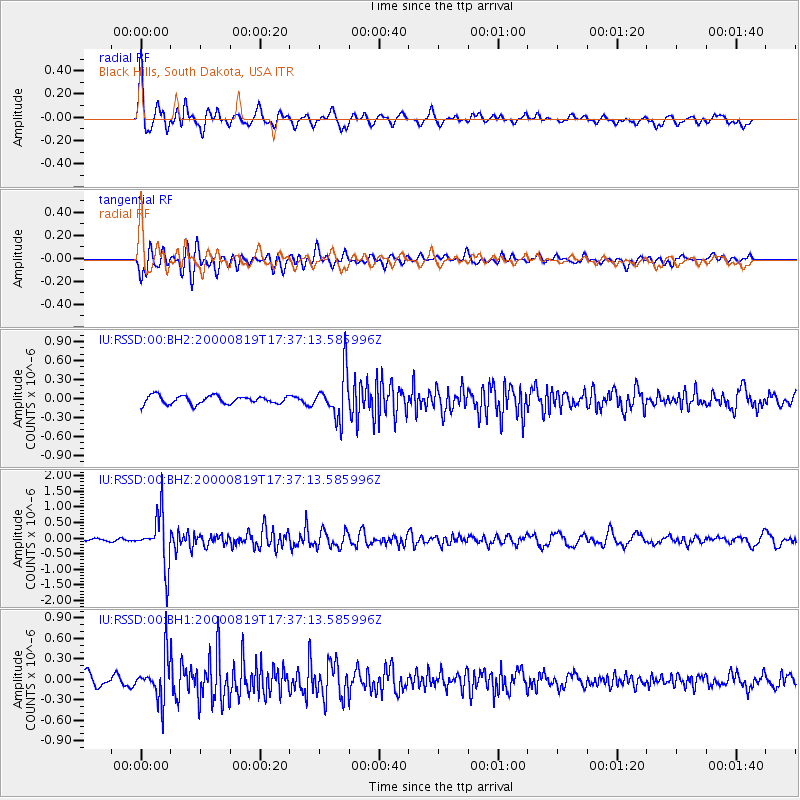
RSSD Black Hills, South Dakota, USA - Earthquake Result Viewer
*The percent match for this event was below the threshold and hence no stack was calculated.
| Earthquake location: |
Kuril Islands |
| Earthquake latitude/longitude: |
43.8/147.2 |
| Earthquake time(UTC): |
2000/08/19 (232) 17:26:27 GMT |
| Earthquake Depth: |
62 km |
| Earthquake Magnitude: |
6.0 MB, 5.8 MW, 5.7 MW |
| Earthquake Catalog/Contributor: |
WHDF/NEIC |
|
| Network: |
IU Global Seismograph Network (GSN - IRIS/USGS) |
| Station: |
RSSD Black Hills, South Dakota, USA |
| Lat/Lon: |
44.12 N/104.04 W |
| Elevation: |
2060 m |
|
| Distance: |
71.9 deg |
| Az: |
45.831 deg |
| Baz: |
313.867 deg |
| Ray Param: |
$rayparam |
*The percent match for this event was below the threshold and hence was not used in the summary stack. |
|
| Radial Match: |
76.333786 % |
| Radial Bump: |
400 |
| Transverse Match: |
70.36992 % |
| Transverse Bump: |
400 |
| SOD ConfigId: |
590571 |
| Insert Time: |
2013-09-24 18:53:41.834 +0000 |
| GWidth: |
2.5 |
| Max Bumps: |
400 |
| Tol: |
0.001 |
|
Signal To Noise
| Channel | StoN | STA | LTA |
| IU:RSSD:00:BHZ:20000819T17:37:13.585996Z | 15.006341 | 8.3133983E-7 | 5.5399237E-8 |
| IU:RSSD:00:BH1:20000819T17:37:13.585996Z | 3.6571164 | 3.0097388E-7 | 8.229814E-8 |
| IU:RSSD:00:BH2:20000819T17:37:13.585996Z | 5.5461135 | 3.5756807E-7 | 6.447183E-8 |
| Arrivals |
| Ps | |
| PpPs | |
| PsPs/PpSs | |


