You are here: Home > Network List > WY - Yellowstone Wyoming Seismic Network Stations List
> Station YHH Holmes Hill, YNP, WY, USA > Earthquake Result Viewer
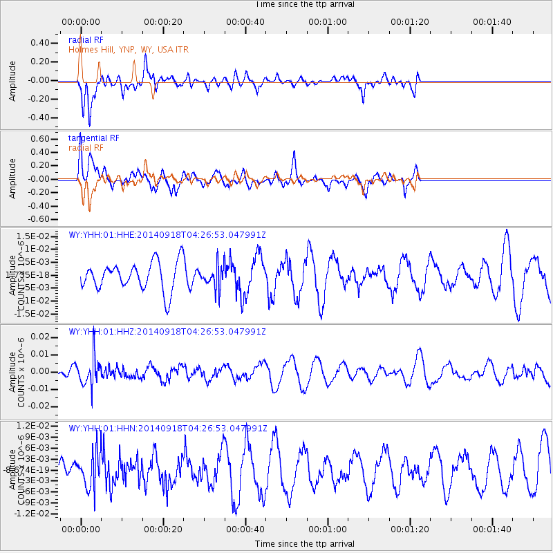
YHH Holmes Hill, YNP, WY, USA - Earthquake Result Viewer
*The percent match for this event was below the threshold and hence no stack was calculated.
| Earthquake location: |
Northwest Of Kuril Islands |
| Earthquake latitude/longitude: |
50.6/150.2 |
| Earthquake time(UTC): |
2014/09/18 (261) 04:17:53 GMT |
| Earthquake Depth: |
502 km |
| Earthquake Magnitude: |
5.6 MW |
| Earthquake Catalog/Contributor: |
ISC/ISC |
|
| Network: |
WY Yellowstone Wyoming Seismic Network |
| Station: |
YHH Holmes Hill, YNP, WY, USA |
| Lat/Lon: |
44.79 N/110.85 W |
| Elevation: |
2717 m |
|
| Distance: |
62.0 deg |
| Az: |
52.831 deg |
| Baz: |
314.473 deg |
| Ray Param: |
$rayparam |
*The percent match for this event was below the threshold and hence was not used in the summary stack. |
|
| Radial Match: |
45.09331 % |
| Radial Bump: |
387 |
| Transverse Match: |
53.04399 % |
| Transverse Bump: |
400 |
| SOD ConfigId: |
3390531 |
| Insert Time: |
2019-04-14 02:51:54.370 +0000 |
| GWidth: |
2.5 |
| Max Bumps: |
400 |
| Tol: |
0.001 |
|
Signal To Noise
| Channel | StoN | STA | LTA |
| WY:YHH:01:HHZ:20140918T04:26:53.047991Z | 2.757657 | 8.031435E-9 | 2.9124128E-9 |
| WY:YHH:01:HHN:20140918T04:26:53.047991Z | 0.9548692 | 4.684762E-9 | 4.9061817E-9 |
| WY:YHH:01:HHE:20140918T04:26:53.047991Z | 0.7897423 | 4.2740713E-9 | 5.4119824E-9 |
| Arrivals |
| Ps | |
| PpPs | |
| PsPs/PpSs | |


