You are here: Home > Network List > CI - Caltech Regional Seismic Network Stations List
> Station LRL Laurel Mtn Radio Fac, Ridgecrest, CA, USA > Earthquake Result Viewer
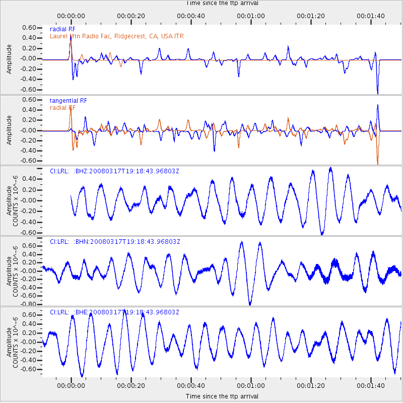
LRL Laurel Mtn Radio Fac, Ridgecrest, CA, USA - Earthquake Result Viewer
*The percent match for this event was below the threshold and hence no stack was calculated.
| Earthquake location: |
Pacific-Antarctic Ridge |
| Earthquake latitude/longitude: |
-54.3/-136.1 |
| Earthquake time(UTC): |
2008/03/17 (077) 19:06:12 GMT |
| Earthquake Depth: |
10 km |
| Earthquake Magnitude: |
5.6 MW, 5.0 MB |
| Earthquake Catalog/Contributor: |
WHDF/NEIC |
|
| Network: |
CI Caltech Regional Seismic Network |
| Station: |
LRL Laurel Mtn Radio Fac, Ridgecrest, CA, USA |
| Lat/Lon: |
35.48 N/117.68 W |
| Elevation: |
1340 m |
|
| Distance: |
90.8 deg |
| Az: |
14.93 deg |
| Baz: |
190.657 deg |
| Ray Param: |
$rayparam |
*The percent match for this event was below the threshold and hence was not used in the summary stack. |
|
| Radial Match: |
28.286121 % |
| Radial Bump: |
347 |
| Transverse Match: |
61.708153 % |
| Transverse Bump: |
400 |
| SOD ConfigId: |
2504 |
| Insert Time: |
2010-02-25 20:42:37.861 +0000 |
| GWidth: |
2.5 |
| Max Bumps: |
400 |
| Tol: |
0.001 |
|
Signal To Noise
| Channel | StoN | STA | LTA |
| CI:LRL: :BHN:20080317T19:18:43.96803Z | 0.8867615 | 1.5074069E-7 | 1.6999012E-7 |
| CI:LRL: :BHE:20080317T19:18:43.96803Z | 1.7114048 | 4.7826893E-7 | 2.7945984E-7 |
| CI:LRL: :BHZ:20080317T19:18:43.96803Z | 0.79993325 | 1.5029043E-7 | 1.8787871E-7 |
| Arrivals |
| Ps | |
| PpPs | |
| PsPs/PpSs | |


