You are here: Home > Network List > IU - Global Seismograph Network (GSN - IRIS/USGS) Stations List
> Station RSSD Black Hills, South Dakota, USA > Earthquake Result Viewer
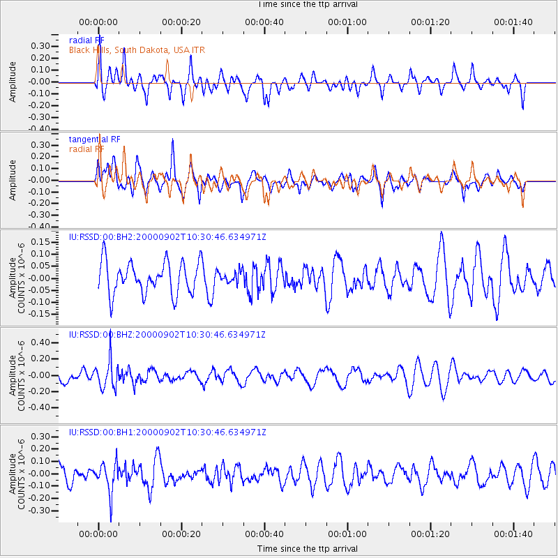
RSSD Black Hills, South Dakota, USA - Earthquake Result Viewer
*The percent match for this event was below the threshold and hence no stack was calculated.
| Earthquake location: |
Fiji Islands Region |
| Earthquake latitude/longitude: |
-17.9/-178.3 |
| Earthquake time(UTC): |
2000/09/02 (246) 10:19:13 GMT |
| Earthquake Depth: |
588 km |
| Earthquake Magnitude: |
5.1 MB, 5.8 MW, 5.7 MW |
| Earthquake Catalog/Contributor: |
WHDF/NEIC |
|
| Network: |
IU Global Seismograph Network (GSN - IRIS/USGS) |
| Station: |
RSSD Black Hills, South Dakota, USA |
| Lat/Lon: |
44.12 N/104.04 W |
| Elevation: |
2060 m |
|
| Distance: |
91.5 deg |
| Az: |
43.911 deg |
| Baz: |
246.47 deg |
| Ray Param: |
$rayparam |
*The percent match for this event was below the threshold and hence was not used in the summary stack. |
|
| Radial Match: |
59.457867 % |
| Radial Bump: |
400 |
| Transverse Match: |
63.77681 % |
| Transverse Bump: |
400 |
| SOD ConfigId: |
590571 |
| Insert Time: |
2013-09-24 18:58:53.977 +0000 |
| GWidth: |
2.5 |
| Max Bumps: |
400 |
| Tol: |
0.001 |
|
Signal To Noise
| Channel | StoN | STA | LTA |
| IU:RSSD:00:BHZ:20000902T10:30:46.634971Z | 2.5746818 | 1.7464264E-7 | 6.783077E-8 |
| IU:RSSD:00:BH1:20000902T10:30:46.634971Z | 2.2188551 | 1.2242064E-7 | 5.5172887E-8 |
| IU:RSSD:00:BH2:20000902T10:30:46.634971Z | 0.35680434 | 2.360323E-8 | 6.615174E-8 |
| Arrivals |
| Ps | |
| PpPs | |
| PsPs/PpSs | |


