You are here: Home > Network List > IU - Global Seismograph Network (GSN - IRIS/USGS) Stations List
> Station RSSD Black Hills, South Dakota, USA > Earthquake Result Viewer
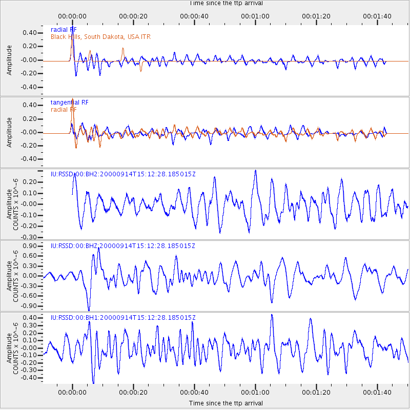
RSSD Black Hills, South Dakota, USA - Earthquake Result Viewer
*The percent match for this event was below the threshold and hence no stack was calculated.
| Earthquake location: |
Fiji Islands |
| Earthquake latitude/longitude: |
-15.7/179.8 |
| Earthquake time(UTC): |
2000/09/14 (258) 14:59:57 GMT |
| Earthquake Depth: |
33 km |
| Earthquake Magnitude: |
5.7 MB, 6.2 MS, 6.3 MW, 6.2 MW |
| Earthquake Catalog/Contributor: |
WHDF/NEIC |
|
| Network: |
IU Global Seismograph Network (GSN - IRIS/USGS) |
| Station: |
RSSD Black Hills, South Dakota, USA |
| Lat/Lon: |
44.12 N/104.04 W |
| Elevation: |
2060 m |
|
| Distance: |
91.2 deg |
| Az: |
44.384 deg |
| Baz: |
249.265 deg |
| Ray Param: |
$rayparam |
*The percent match for this event was below the threshold and hence was not used in the summary stack. |
|
| Radial Match: |
74.40454 % |
| Radial Bump: |
400 |
| Transverse Match: |
67.730354 % |
| Transverse Bump: |
400 |
| SOD ConfigId: |
590571 |
| Insert Time: |
2013-09-24 19:03:29.068 +0000 |
| GWidth: |
2.5 |
| Max Bumps: |
400 |
| Tol: |
0.001 |
|
Signal To Noise
| Channel | StoN | STA | LTA |
| IU:RSSD:00:BHZ:20000914T15:12:28.185015Z | 2.6984086 | 2.017091E-7 | 7.475113E-8 |
| IU:RSSD:00:BH1:20000914T15:12:28.185015Z | 1.2025971 | 1.1668063E-7 | 9.702387E-8 |
| IU:RSSD:00:BH2:20000914T15:12:28.185015Z | 0.7104058 | 6.453624E-8 | 9.084418E-8 |
| Arrivals |
| Ps | |
| PpPs | |
| PsPs/PpSs | |


