You are here: Home > Network List > IU - Global Seismograph Network (GSN - IRIS/USGS) Stations List
> Station JOHN Johnston Island, USA > Earthquake Result Viewer
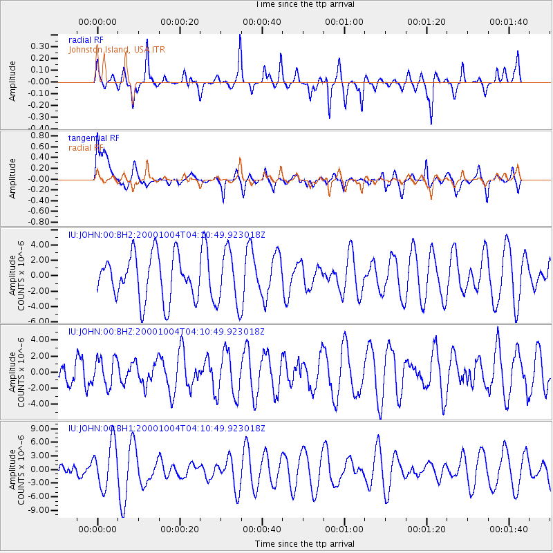
JOHN Johnston Island, USA - Earthquake Result Viewer
*The percent match for this event was below the threshold and hence no stack was calculated.
| Earthquake location: |
Pacific-Antarctic Ridge |
| Earthquake latitude/longitude: |
-55.4/-128.1 |
| Earthquake time(UTC): |
2000/10/04 (278) 03:59:12 GMT |
| Earthquake Depth: |
10 km |
| Earthquake Magnitude: |
5.8 MW |
| Earthquake Catalog/Contributor: |
NEIC PDE/NEIC PDE-M |
|
| Network: |
IU Global Seismograph Network (GSN - IRIS/USGS) |
| Station: |
JOHN Johnston Island, USA |
| Lat/Lon: |
16.73 N/169.53 W |
| Elevation: |
2.0 m |
|
| Distance: |
80.0 deg |
| Az: |
319.9 deg |
| Baz: |
157.471 deg |
| Ray Param: |
$rayparam |
*The percent match for this event was below the threshold and hence was not used in the summary stack. |
|
| Radial Match: |
47.088905 % |
| Radial Bump: |
338 |
| Transverse Match: |
50.906437 % |
| Transverse Bump: |
400 |
| SOD ConfigId: |
590571 |
| Insert Time: |
2013-09-24 19:09:21.957 +0000 |
| GWidth: |
2.5 |
| Max Bumps: |
400 |
| Tol: |
0.001 |
|
Signal To Noise
| Channel | StoN | STA | LTA |
| IU:JOHN:00:BHZ:20001004T04:10:49.923018Z | 0.69513905 | 1.7668733E-6 | 2.541755E-6 |
| IU:JOHN:00:BH1:20001004T04:10:49.923018Z | 2.9250891 | 5.131376E-6 | 1.7542632E-6 |
| IU:JOHN:00:BH2:20001004T04:10:49.923018Z | 1.2446519 | 3.5769597E-6 | 2.8738634E-6 |
| Arrivals |
| Ps | |
| PpPs | |
| PsPs/PpSs | |


