You are here: Home > Network List > IU - Global Seismograph Network (GSN - IRIS/USGS) Stations List
> Station POHA Pohakuloa, Hawaii, USA > Earthquake Result Viewer
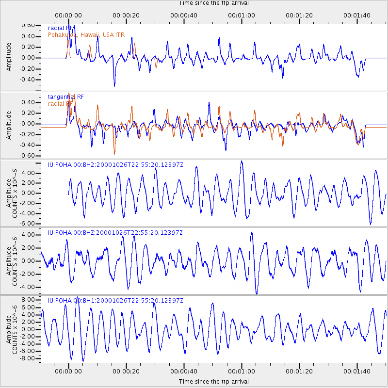
POHA Pohakuloa, Hawaii, USA - Earthquake Result Viewer
*The percent match for this event was below the threshold and hence no stack was calculated.
| Earthquake location: |
Banda Sea |
| Earthquake latitude/longitude: |
-6.9/129.0 |
| Earthquake time(UTC): |
2000/10/26 (300) 22:44:05 GMT |
| Earthquake Depth: |
158 km |
| Earthquake Magnitude: |
5.5 MW |
| Earthquake Catalog/Contributor: |
NEIC PDE/NEIC PDE-M |
|
| Network: |
IU Global Seismograph Network (GSN - IRIS/USGS) |
| Station: |
POHA Pohakuloa, Hawaii, USA |
| Lat/Lon: |
19.76 N/155.53 W |
| Elevation: |
1967 m |
|
| Distance: |
78.8 deg |
| Az: |
68.344 deg |
| Baz: |
258.424 deg |
| Ray Param: |
$rayparam |
*The percent match for this event was below the threshold and hence was not used in the summary stack. |
|
| Radial Match: |
66.09646 % |
| Radial Bump: |
400 |
| Transverse Match: |
67.61999 % |
| Transverse Bump: |
400 |
| SOD ConfigId: |
590571 |
| Insert Time: |
2013-09-24 19:17:49.750 +0000 |
| GWidth: |
2.5 |
| Max Bumps: |
400 |
| Tol: |
0.001 |
|
Signal To Noise
| Channel | StoN | STA | LTA |
| IU:POHA:00:BHZ:20001026T22:55:20.12397Z | 0.83581036 | 2.0129187E-6 | 2.4083438E-6 |
| IU:POHA:00:BH1:20001026T22:55:20.12397Z | 2.2671387 | 5.6852755E-6 | 2.5076874E-6 |
| IU:POHA:00:BH2:20001026T22:55:20.12397Z | 1.1037908 | 2.4231456E-6 | 2.1952942E-6 |
| Arrivals |
| Ps | |
| PpPs | |
| PsPs/PpSs | |


