You are here: Home > Network List > IU - Global Seismograph Network (GSN - IRIS/USGS) Stations List
> Station RSSD Black Hills, South Dakota, USA > Earthquake Result Viewer
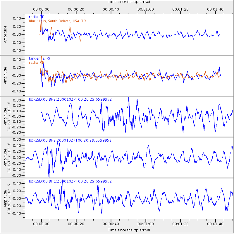
RSSD Black Hills, South Dakota, USA - Earthquake Result Viewer
*The percent match for this event was below the threshold and hence no stack was calculated.
| Earthquake location: |
Southwestern Siberia, Russia |
| Earthquake latitude/longitude: |
54.7/95.0 |
| Earthquake time(UTC): |
2000/10/27 (301) 00:08:53 GMT |
| Earthquake Depth: |
33 km |
| Earthquake Magnitude: |
5.6 MB, 5.5 MW, 5.7 MW |
| Earthquake Catalog/Contributor: |
NEIC PDE/NEIC PDE-M |
|
| Network: |
IU Global Seismograph Network (GSN - IRIS/USGS) |
| Station: |
RSSD Black Hills, South Dakota, USA |
| Lat/Lon: |
44.12 N/104.04 W |
| Elevation: |
2060 m |
|
| Distance: |
80.2 deg |
| Az: |
13.778 deg |
| Baz: |
348.936 deg |
| Ray Param: |
$rayparam |
*The percent match for this event was below the threshold and hence was not used in the summary stack. |
|
| Radial Match: |
59.947796 % |
| Radial Bump: |
400 |
| Transverse Match: |
61.475887 % |
| Transverse Bump: |
400 |
| SOD ConfigId: |
590571 |
| Insert Time: |
2013-09-24 19:18:24.026 +0000 |
| GWidth: |
2.5 |
| Max Bumps: |
400 |
| Tol: |
0.001 |
|
Signal To Noise
| Channel | StoN | STA | LTA |
| IU:RSSD:00:BHZ:20001027T00:20:29.659995Z | 2.1869113 | 3.1129636E-7 | 1.4234521E-7 |
| IU:RSSD:00:BH1:20001027T00:20:29.659995Z | 1.0158707 | 8.998252E-8 | 8.857675E-8 |
| IU:RSSD:00:BH2:20001027T00:20:29.659995Z | 0.938473 | 1.035538E-7 | 1.10342874E-7 |
| Arrivals |
| Ps | |
| PpPs | |
| PsPs/PpSs | |


