You are here: Home > Network List > IU - Global Seismograph Network (GSN - IRIS/USGS) Stations List
> Station TEIG Tepich, Yucatan, Mexico > Earthquake Result Viewer
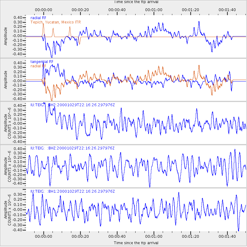
TEIG Tepich, Yucatan, Mexico - Earthquake Result Viewer
*The percent match for this event was below the threshold and hence no stack was calculated.
| Earthquake location: |
East Of Kuril Islands |
| Earthquake latitude/longitude: |
47.8/155.7 |
| Earthquake time(UTC): |
2000/10/29 (303) 22:03:56 GMT |
| Earthquake Depth: |
50 km |
| Earthquake Magnitude: |
5.7 MB, 5.5 MW |
| Earthquake Catalog/Contributor: |
NEIC PDE/NEIC PDE-M |
|
| Network: |
IU Global Seismograph Network (GSN - IRIS/USGS) |
| Station: |
TEIG Tepich, Yucatan, Mexico |
| Lat/Lon: |
20.23 N/88.28 W |
| Elevation: |
69 m |
|
| Distance: |
91.4 deg |
| Az: |
57.541 deg |
| Baz: |
322.701 deg |
| Ray Param: |
$rayparam |
*The percent match for this event was below the threshold and hence was not used in the summary stack. |
|
| Radial Match: |
33.276432 % |
| Radial Bump: |
400 |
| Transverse Match: |
51.524605 % |
| Transverse Bump: |
400 |
| SOD ConfigId: |
590571 |
| Insert Time: |
2013-09-24 19:19:53.680 +0000 |
| GWidth: |
2.5 |
| Max Bumps: |
400 |
| Tol: |
0.001 |
|
Signal To Noise
| Channel | StoN | STA | LTA |
| IU:TEIG: :BHZ:20001029T22:16:26.297976Z | 1.4251935 | 1.7804874E-7 | 1.2492951E-7 |
| IU:TEIG: :BH1:20001029T22:16:26.297976Z | 1.0198673 | 1.4487918E-7 | 1.4205689E-7 |
| IU:TEIG: :BH2:20001029T22:16:26.297976Z | 0.96437865 | 1.9070862E-7 | 1.9775284E-7 |
| Arrivals |
| Ps | |
| PpPs | |
| PsPs/PpSs | |


