You are here: Home > Network List > IU - Global Seismograph Network (GSN - IRIS/USGS) Stations List
> Station TEIG Tepich, Yucatan, Mexico > Earthquake Result Viewer
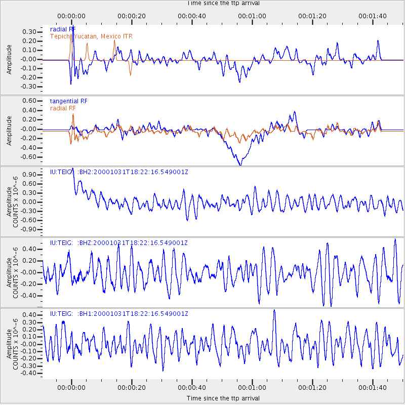
TEIG Tepich, Yucatan, Mexico - Earthquake Result Viewer
*The percent match for this event was below the threshold and hence no stack was calculated.
| Earthquake location: |
Tonga Islands |
| Earthquake latitude/longitude: |
-18.0/-175.3 |
| Earthquake time(UTC): |
2000/10/31 (305) 18:09:36 GMT |
| Earthquake Depth: |
33 km |
| Earthquake Magnitude: |
5.6 MS, 5.7 MW |
| Earthquake Catalog/Contributor: |
NEIC PDE/NEIC PDE-M |
|
| Network: |
IU Global Seismograph Network (GSN - IRIS/USGS) |
| Station: |
TEIG Tepich, Yucatan, Mexico |
| Lat/Lon: |
20.23 N/88.28 W |
| Elevation: |
69 m |
|
| Distance: |
93.3 deg |
| Az: |
69.947 deg |
| Baz: |
252.205 deg |
| Ray Param: |
$rayparam |
*The percent match for this event was below the threshold and hence was not used in the summary stack. |
|
| Radial Match: |
68.83127 % |
| Radial Bump: |
400 |
| Transverse Match: |
36.1764 % |
| Transverse Bump: |
400 |
| SOD ConfigId: |
590571 |
| Insert Time: |
2013-09-24 19:21:16.517 +0000 |
| GWidth: |
2.5 |
| Max Bumps: |
400 |
| Tol: |
0.001 |
|
Signal To Noise
| Channel | StoN | STA | LTA |
| IU:TEIG: :BHZ:20001031T18:22:16.549001Z | 0.79054046 | 1.4267701E-7 | 1.8048034E-7 |
| IU:TEIG: :BH1:20001031T18:22:16.549001Z | 0.6006961 | 1.1238606E-7 | 1.8709305E-7 |
| IU:TEIG: :BH2:20001031T18:22:16.549001Z | 0.7736012 | 2.3281268E-7 | 3.0094665E-7 |
| Arrivals |
| Ps | |
| PpPs | |
| PsPs/PpSs | |


