You are here: Home > Network List > IU - Global Seismograph Network (GSN - IRIS/USGS) Stations List
> Station RSSD Black Hills, South Dakota, USA > Earthquake Result Viewer
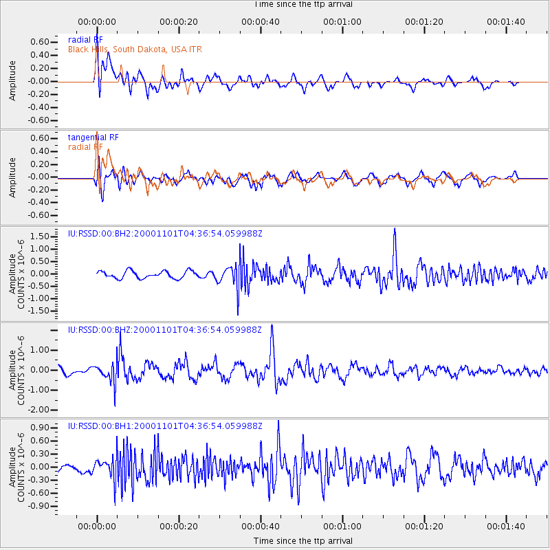
RSSD Black Hills, South Dakota, USA - Earthquake Result Viewer
*The percent match for this event was below the threshold and hence no stack was calculated.
| Earthquake location: |
Peru-Brazil Border Region |
| Earthquake latitude/longitude: |
-7.9/-74.4 |
| Earthquake time(UTC): |
2000/11/01 (306) 04:27:45 GMT |
| Earthquake Depth: |
151 km |
| Earthquake Magnitude: |
5.9 MB, 5.9 MW |
| Earthquake Catalog/Contributor: |
WHDF/NEIC |
|
| Network: |
IU Global Seismograph Network (GSN - IRIS/USGS) |
| Station: |
RSSD Black Hills, South Dakota, USA |
| Lat/Lon: |
44.12 N/104.04 W |
| Elevation: |
2060 m |
|
| Distance: |
58.3 deg |
| Az: |
335.284 deg |
| Baz: |
144.897 deg |
| Ray Param: |
$rayparam |
*The percent match for this event was below the threshold and hence was not used in the summary stack. |
|
| Radial Match: |
68.12895 % |
| Radial Bump: |
400 |
| Transverse Match: |
77.25304 % |
| Transverse Bump: |
400 |
| SOD ConfigId: |
590571 |
| Insert Time: |
2013-09-24 19:21:48.751 +0000 |
| GWidth: |
2.5 |
| Max Bumps: |
400 |
| Tol: |
0.001 |
|
Signal To Noise
| Channel | StoN | STA | LTA |
| IU:RSSD:00:BHZ:20001101T04:36:54.059988Z | 3.5844607 | 4.7662556E-7 | 1.3296994E-7 |
| IU:RSSD:00:BH1:20001101T04:36:54.059988Z | 2.3122315 | 2.4576644E-7 | 1.0628972E-7 |
| IU:RSSD:00:BH2:20001101T04:36:54.059988Z | 3.0689738 | 4.4796153E-7 | 1.459646E-7 |
| Arrivals |
| Ps | |
| PpPs | |
| PsPs/PpSs | |


