You are here: Home > Network List > IU - Global Seismograph Network (GSN - IRIS/USGS) Stations List
> Station JOHN Johnston Island, USA > Earthquake Result Viewer
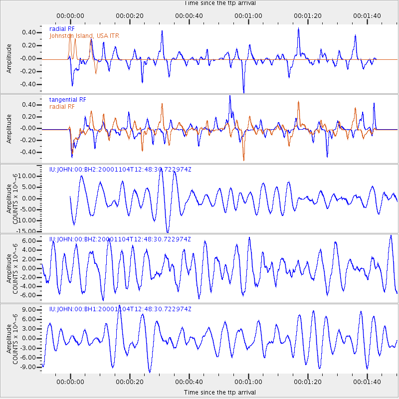
JOHN Johnston Island, USA - Earthquake Result Viewer
*The percent match for this event was below the threshold and hence no stack was calculated.
| Earthquake location: |
Mindanao, Philippines |
| Earthquake latitude/longitude: |
5.8/125.8 |
| Earthquake time(UTC): |
2000/11/04 (309) 12:38:41 GMT |
| Earthquake Depth: |
134 km |
| Earthquake Magnitude: |
5.8 MW |
| Earthquake Catalog/Contributor: |
NEIC PDE/NEIC PDE-M |
|
| Network: |
IU Global Seismograph Network (GSN - IRIS/USGS) |
| Station: |
JOHN Johnston Island, USA |
| Lat/Lon: |
16.73 N/169.53 W |
| Elevation: |
2.0 m |
|
| Distance: |
64.1 deg |
| Az: |
74.277 deg |
| Baz: |
268.337 deg |
| Ray Param: |
$rayparam |
*The percent match for this event was below the threshold and hence was not used in the summary stack. |
|
| Radial Match: |
67.82647 % |
| Radial Bump: |
400 |
| Transverse Match: |
60.035995 % |
| Transverse Bump: |
289 |
| SOD ConfigId: |
590571 |
| Insert Time: |
2013-09-24 19:22:41.513 +0000 |
| GWidth: |
2.5 |
| Max Bumps: |
400 |
| Tol: |
0.001 |
|
Signal To Noise
| Channel | StoN | STA | LTA |
| IU:JOHN:00:BHZ:20001104T12:48:30.722974Z | 0.9147795 | 3.5725598E-6 | 3.905378E-6 |
| IU:JOHN:00:BH1:20001104T12:48:30.722974Z | 0.31180155 | 1.2875133E-6 | 4.1292715E-6 |
| IU:JOHN:00:BH2:20001104T12:48:30.722974Z | 1.8859276 | 9.6378235E-6 | 5.110389E-6 |
| Arrivals |
| Ps | |
| PpPs | |
| PsPs/PpSs | |


