You are here: Home > Network List > IU - Global Seismograph Network (GSN - IRIS/USGS) Stations List
> Station JOHN Johnston Island, USA > Earthquake Result Viewer
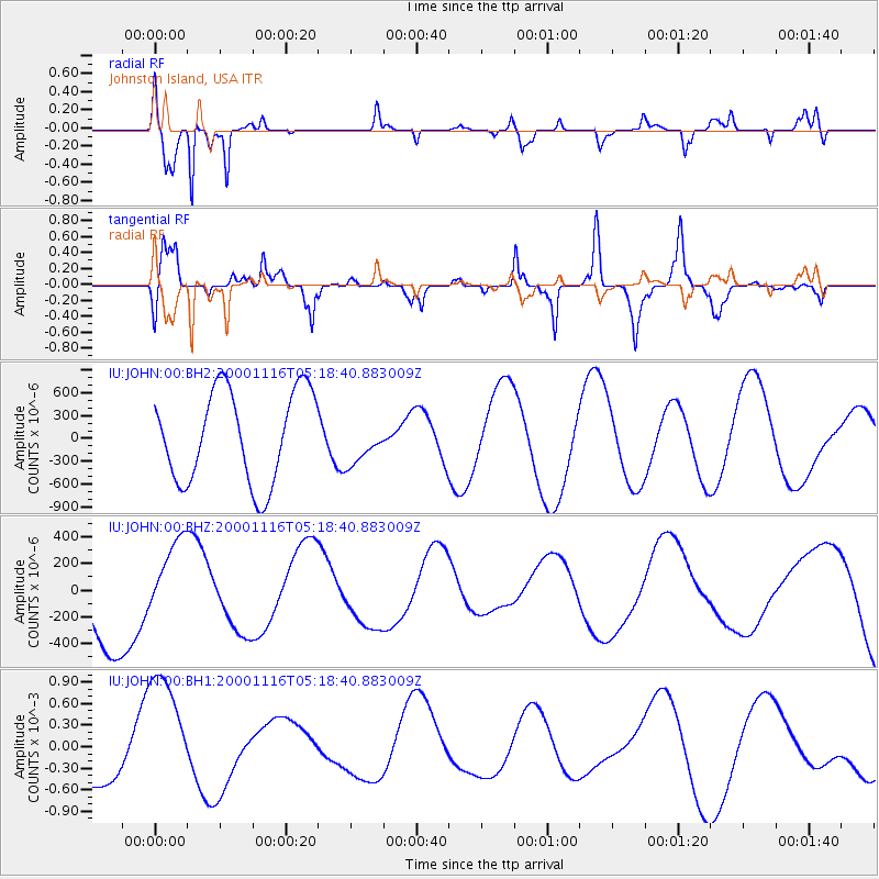
JOHN Johnston Island, USA - Earthquake Result Viewer
*The percent match for this event was below the threshold and hence no stack was calculated.
| Earthquake location: |
New Ireland Region, P.N.G. |
| Earthquake latitude/longitude: |
-5.3/153.5 |
| Earthquake time(UTC): |
2000/11/16 (321) 05:11:18 GMT |
| Earthquake Depth: |
33 km |
| Earthquake Magnitude: |
5.8 MB |
| Earthquake Catalog/Contributor: |
NEIC PDE/NEIC PDE-M |
|
| Network: |
IU Global Seismograph Network (GSN - IRIS/USGS) |
| Station: |
JOHN Johnston Island, USA |
| Lat/Lon: |
16.73 N/169.53 W |
| Elevation: |
2.0 m |
|
| Distance: |
42.6 deg |
| Az: |
58.353 deg |
| Baz: |
242.21 deg |
| Ray Param: |
$rayparam |
*The percent match for this event was below the threshold and hence was not used in the summary stack. |
|
| Radial Match: |
84.55679 % |
| Radial Bump: |
283 |
| Transverse Match: |
57.135967 % |
| Transverse Bump: |
283 |
| SOD ConfigId: |
590571 |
| Insert Time: |
2013-09-24 19:29:22.953 +0000 |
| GWidth: |
2.5 |
| Max Bumps: |
400 |
| Tol: |
0.001 |
|
Signal To Noise
| Channel | StoN | STA | LTA |
| IU:JOHN:00:BHZ:20001116T05:18:40.883009Z | 0.845122 | 3.205994E-4 | 3.7935283E-4 |
| IU:JOHN:00:BH1:20001116T05:18:40.883009Z | 1.9761631 | 8.51184E-4 | 4.3072557E-4 |
| IU:JOHN:00:BH2:20001116T05:18:40.883009Z | 0.46193236 | 2.7711442E-4 | 5.9990253E-4 |
| Arrivals |
| Ps | |
| PpPs | |
| PsPs/PpSs | |


