
JOHN Johnston Island, USA - Earthquake Result Viewer
| ||||||||||||||||||
| ||||||||||||||||||
| ||||||||||||||||||
|
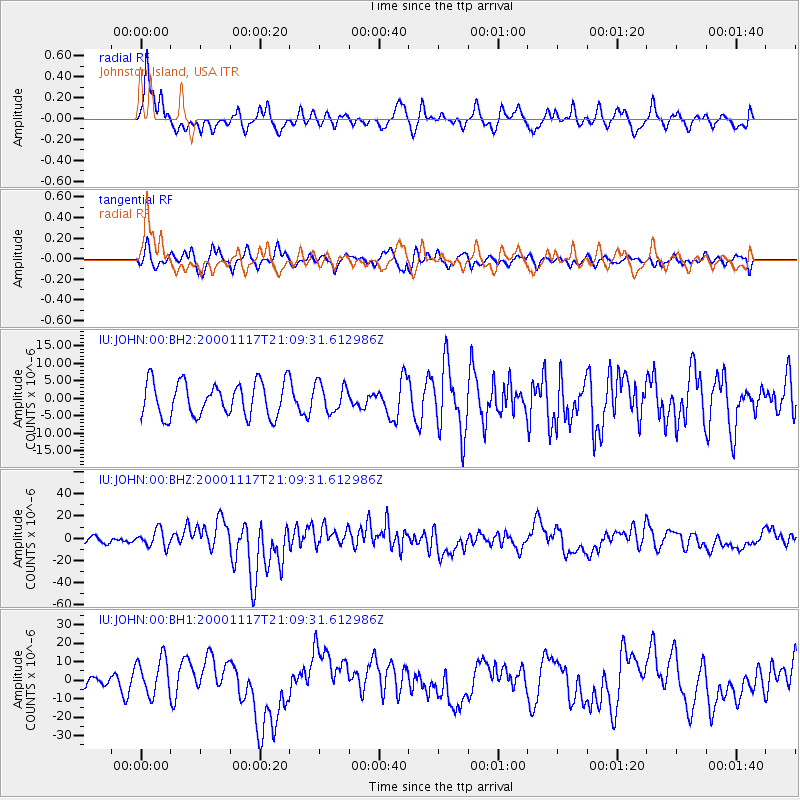
Signal To Noise
| Channel | StoN | STA | LTA |
| IU:JOHN:00:BHZ:20001117T21:09:31.612986Z | 1.4743936 | 7.621208E-6 | 5.169046E-6 |
| IU:JOHN:00:BH1:20001117T21:09:31.612986Z | 3.800065 | 1.0108777E-5 | 2.660159E-6 |
| IU:JOHN:00:BH2:20001117T21:09:31.612986Z | 0.83094054 | 4.059966E-6 | 4.885989E-6 |
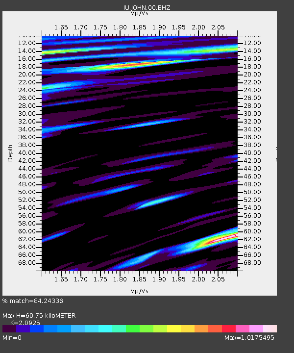
| Arrivals | |
| Ps | 16 SECOND |
| PpPs | 43 SECOND |
| PsPs/PpSs | 59 SECOND |

