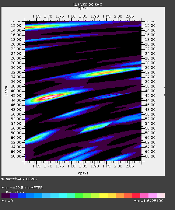
SNZO South Karori, New Zealand - Earthquake Result Viewer
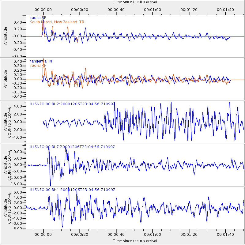
Earthquake location: New Britain Region, P.N.G.
Earthquake latitude/longitude: -4.2/152.7
Earthquake time(UTC): 2000/12/06 (341) 22:57:40 GMT
Earthquake Depth: 31 km
Earthquake Magnitude: 6.1 MB, 6.6 MS, 6.6 MW, 6.2 ME
Earthquake Catalog/Contributor: WHDF/NEIC
Network: IU Global Seismograph Network (GSN - IRIS/USGS)
Station: SNZO South Karori, New Zealand
Lat/Lon: 41.31 S/174.70 E
Elevation: 62 m
Distance: 41.9 deg
Az: 155.006 deg
Baz: 325.988 deg
Ray Param: 0.07346134
Estimated Moho Depth: 42.5 km
Estimated Crust Vp/Vs: 1.70
Assumed Crust Vp: 6.461 km/s
Estimated Crust Vs: 3.795 km/s
Estimated Crust Poisson's Ratio: 0.24
Radial Match: 87.88282 %
Radial Bump: 400
Transverse Match: 79.51172 %
Transverse Bump: 400
SOD ConfigId: 590571
Insert Time: 2013-09-24 19:45:38.441 +0000
GWidth: 2.5
Max Bumps: 400
Tol: 0.001

Signal To Noise

ChannelStoNSTALTA
IU:SNZO:00:BHZ:20001206T23:04:56.71099Z22.109786.3970115E-62.893295E-7
IU:SNZO:00:BH1:20001206T23:04:56.71099Z4.3753681.8212183E-64.1624344E-7
IU:SNZO:00:BH2:20001206T23:04:56.71099Z1.77372671.0435487E-65.8833683E-7
Arrivals
Ps5.0 SECOND
PpPs17 SECOND
PsPs/PpSs22 SECOND