You are here: Home > Network List > IU - Global Seismograph Network (GSN - IRIS/USGS) Stations List
> Station RSSD Black Hills, South Dakota, USA > Earthquake Result Viewer
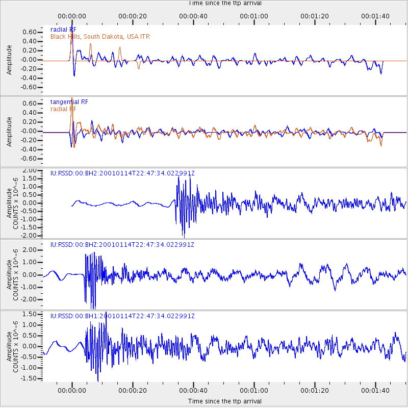
RSSD Black Hills, South Dakota, USA - Earthquake Result Viewer
*The percent match for this event was below the threshold and hence no stack was calculated.
| Earthquake location: |
El Salvador |
| Earthquake latitude/longitude: |
13.1/-88.6 |
| Earthquake time(UTC): |
2001/01/14 (014) 22:41:28 GMT |
| Earthquake Depth: |
49 km |
| Earthquake Magnitude: |
5.7 MW |
| Earthquake Catalog/Contributor: |
NEIC PDE/NEIC PDE-M |
|
| Network: |
IU Global Seismograph Network (GSN - IRIS/USGS) |
| Station: |
RSSD Black Hills, South Dakota, USA |
| Lat/Lon: |
44.12 N/104.04 W |
| Elevation: |
2060 m |
|
| Distance: |
33.6 deg |
| Az: |
339.733 deg |
| Baz: |
152.058 deg |
| Ray Param: |
$rayparam |
*The percent match for this event was below the threshold and hence was not used in the summary stack. |
|
| Radial Match: |
53.75048 % |
| Radial Bump: |
400 |
| Transverse Match: |
60.946995 % |
| Transverse Bump: |
400 |
| SOD ConfigId: |
590571 |
| Insert Time: |
2013-09-24 20:02:27.810 +0000 |
| GWidth: |
2.5 |
| Max Bumps: |
400 |
| Tol: |
0.001 |
|
Signal To Noise
| Channel | StoN | STA | LTA |
| IU:RSSD:00:BHZ:20010114T22:47:34.022991Z | 1.7627811 | 5.429976E-7 | 3.080346E-7 |
| IU:RSSD:00:BH1:20010114T22:47:34.022991Z | 1.2286363 | 2.143316E-7 | 1.7444675E-7 |
| IU:RSSD:00:BH2:20010114T22:47:34.022991Z | 3.4064128 | 3.0397123E-7 | 8.9234995E-8 |
| Arrivals |
| Ps | |
| PpPs | |
| PsPs/PpSs | |


