You are here: Home > Network List > II - Global Seismograph Network (GSN - IRIS/IDA) Stations List
> Station MBAR Mbarara, Uganda > Earthquake Result Viewer
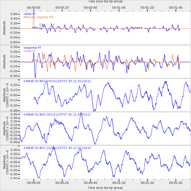
MBAR Mbarara, Uganda - Earthquake Result Viewer
*The percent match for this event was below the threshold and hence no stack was calculated.
| Earthquake location: |
Southern India |
| Earthquake latitude/longitude: |
23.3/70.0 |
| Earthquake time(UTC): |
2001/01/26 (026) 07:32:28 GMT |
| Earthquake Depth: |
10 km |
| Earthquake Magnitude: |
5.5 MS |
| Earthquake Catalog/Contributor: |
NEIC PDE/NEIC PDE-M |
|
| Network: |
II Global Seismograph Network (GSN - IRIS/IDA) |
| Station: |
MBAR Mbarara, Uganda |
| Lat/Lon: |
0.60 S/30.74 E |
| Elevation: |
1390 m |
|
| Distance: |
44.9 deg |
| Az: |
243.573 deg |
| Baz: |
55.414 deg |
| Ray Param: |
$rayparam |
*The percent match for this event was below the threshold and hence was not used in the summary stack. |
|
| Radial Match: |
60.603664 % |
| Radial Bump: |
400 |
| Transverse Match: |
59.819595 % |
| Transverse Bump: |
400 |
| SOD ConfigId: |
590571 |
| Insert Time: |
2013-09-24 20:08:57.109 +0000 |
| GWidth: |
2.5 |
| Max Bumps: |
400 |
| Tol: |
0.001 |
|
Signal To Noise
| Channel | StoN | STA | LTA |
| II:MBAR:00:BHZ:20010126T07:40:12.822001Z | 0.3515604 | 8.854365E-8 | 2.5185898E-7 |
| II:MBAR:00:BH1:20010126T07:40:12.822001Z | 2.2893918 | 2.6310386E-7 | 1.1492303E-7 |
| II:MBAR:00:BH2:20010126T07:40:12.822001Z | 0.8816609 | 1.138978E-7 | 1.291855E-7 |
| Arrivals |
| Ps | |
| PpPs | |
| PsPs/PpSs | |


