You are here: Home > Network List > II - Global Seismograph Network (GSN - IRIS/IDA) Stations List
> Station MBAR Mbarara, Uganda > Earthquake Result Viewer
MBAR Mbarara, Uganda - Earthquake Result Viewer

| Earthquake location: |
Bali Sea |
| Earthquake latitude/longitude: |
-7.2/117.5 |
| Earthquake time(UTC): |
2001/02/16 (047) 05:59:09 GMT |
| Earthquake Depth: |
521 km |
| Earthquake Magnitude: |
5.9 MB, 6.1 MW, 6.0 MW |
| Earthquake Catalog/Contributor: |
WHDF/NEIC |
|
| Network: |
II Global Seismograph Network (GSN - IRIS/IDA) |
| Station: |
MBAR Mbarara, Uganda |
| Lat/Lon: |
0.60 S/30.74 E |
| Elevation: |
1390 m |
|
| Distance: |
86.7 deg |
| Az: |
269.809 deg |
| Baz: |
97.091 deg |
| Ray Param: |
0.042406388 |
| Estimated Moho Depth: |
64.75 km |
| Estimated Crust Vp/Vs: |
1.88 |
| Assumed Crust Vp: |
6.419 km/s |
| Estimated Crust Vs: |
3.405 km/s |
| Estimated Crust Poisson's Ratio: |
0.30 |
|
| Radial Match: |
93.691635 % |
| Radial Bump: |
400 |
| Transverse Match: |
93.32216 % |
| Transverse Bump: |
400 |
| SOD ConfigId: |
590571 |
| Insert Time: |
2013-09-24 20:14:30.434 +0000 |
| GWidth: |
2.5 |
| Max Bumps: |
400 |
| Tol: |
0.001 |
|
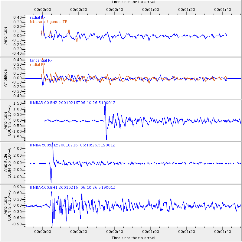
Signal To Noise
| Channel | StoN | STA | LTA |
| II:MBAR:00:BHZ:20010216T06:10:26.519001Z | 23.851912 | 1.4370617E-6 | 6.024933E-8 |
| II:MBAR:00:BH1:20010216T06:10:26.519001Z | 4.755355 | 1.4504535E-7 | 3.0501475E-8 |
| II:MBAR:00:BH2:20010216T06:10:26.519001Z | 10.158953 | 4.845184E-7 | 4.7693735E-8 |
| Arrivals |
| Ps | 9.1 SECOND |
| PpPs | 29 SECOND |
| PsPs/PpSs | 38 SECOND |


