You are here: Home > Network List > IU - Global Seismograph Network (GSN - IRIS/USGS) Stations List
> Station POHA Pohakuloa, Hawaii, USA > Earthquake Result Viewer
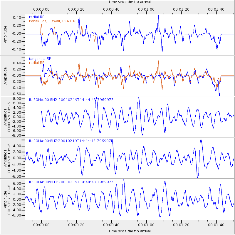
POHA Pohakuloa, Hawaii, USA - Earthquake Result Viewer
*The percent match for this event was below the threshold and hence no stack was calculated.
| Earthquake location: |
Off Coast Of Southern Chile |
| Earthquake latitude/longitude: |
-45.1/-79.3 |
| Earthquake time(UTC): |
2001/02/19 (050) 14:31:55 GMT |
| Earthquake Depth: |
10 km |
| Earthquake Magnitude: |
5.1 MB, 5.2 MS, 5.8 MW |
| Earthquake Catalog/Contributor: |
WHDF/NEIC |
|
| Network: |
IU Global Seismograph Network (GSN - IRIS/USGS) |
| Station: |
POHA Pohakuloa, Hawaii, USA |
| Lat/Lon: |
19.76 N/155.53 W |
| Elevation: |
1967 m |
|
| Distance: |
94.5 deg |
| Az: |
293.409 deg |
| Baz: |
136.361 deg |
| Ray Param: |
$rayparam |
*The percent match for this event was below the threshold and hence was not used in the summary stack. |
|
| Radial Match: |
49.420563 % |
| Radial Bump: |
400 |
| Transverse Match: |
41.785732 % |
| Transverse Bump: |
400 |
| SOD ConfigId: |
590571 |
| Insert Time: |
2013-09-24 20:15:49.358 +0000 |
| GWidth: |
2.5 |
| Max Bumps: |
400 |
| Tol: |
0.001 |
|
Signal To Noise
| Channel | StoN | STA | LTA |
| IU:POHA:00:BHZ:20010219T14:44:43.796997Z | 1.1075561 | 1.8748125E-6 | 1.6927472E-6 |
| IU:POHA:00:BH1:20010219T14:44:43.796997Z | 1.6877854 | 3.1241134E-6 | 1.8510134E-6 |
| IU:POHA:00:BH2:20010219T14:44:43.796997Z | 2.5883415 | 5.064259E-6 | 1.9565653E-6 |
| Arrivals |
| Ps | |
| PpPs | |
| PsPs/PpSs | |


