You are here: Home > Network List > II - Global Seismograph Network (GSN - IRIS/IDA) Stations List
> Station MBAR Mbarara, Uganda > Earthquake Result Viewer
MBAR Mbarara, Uganda - Earthquake Result Viewer

| Earthquake location: |
Hindu Kush Region, Afghanistan |
| Earthquake latitude/longitude: |
36.4/70.9 |
| Earthquake time(UTC): |
2001/02/25 (056) 02:21:59 GMT |
| Earthquake Depth: |
202 km |
| Earthquake Magnitude: |
5.8 MB, 6.3 MW, 6.1 MW |
| Earthquake Catalog/Contributor: |
WHDF/NEIC |
|
| Network: |
II Global Seismograph Network (GSN - IRIS/IDA) |
| Station: |
MBAR Mbarara, Uganda |
| Lat/Lon: |
0.60 S/30.74 E |
| Elevation: |
1390 m |
|
| Distance: |
52.4 deg |
| Az: |
234.472 deg |
| Baz: |
41.028 deg |
| Ray Param: |
0.06606701 |
| Estimated Moho Depth: |
24.5 km |
| Estimated Crust Vp/Vs: |
2.10 |
| Assumed Crust Vp: |
6.419 km/s |
| Estimated Crust Vs: |
3.06 km/s |
| Estimated Crust Poisson's Ratio: |
0.35 |
|
| Radial Match: |
92.46257 % |
| Radial Bump: |
400 |
| Transverse Match: |
81.73586 % |
| Transverse Bump: |
400 |
| SOD ConfigId: |
590571 |
| Insert Time: |
2013-09-24 20:19:33.006 +0000 |
| GWidth: |
2.5 |
| Max Bumps: |
400 |
| Tol: |
0.001 |
|
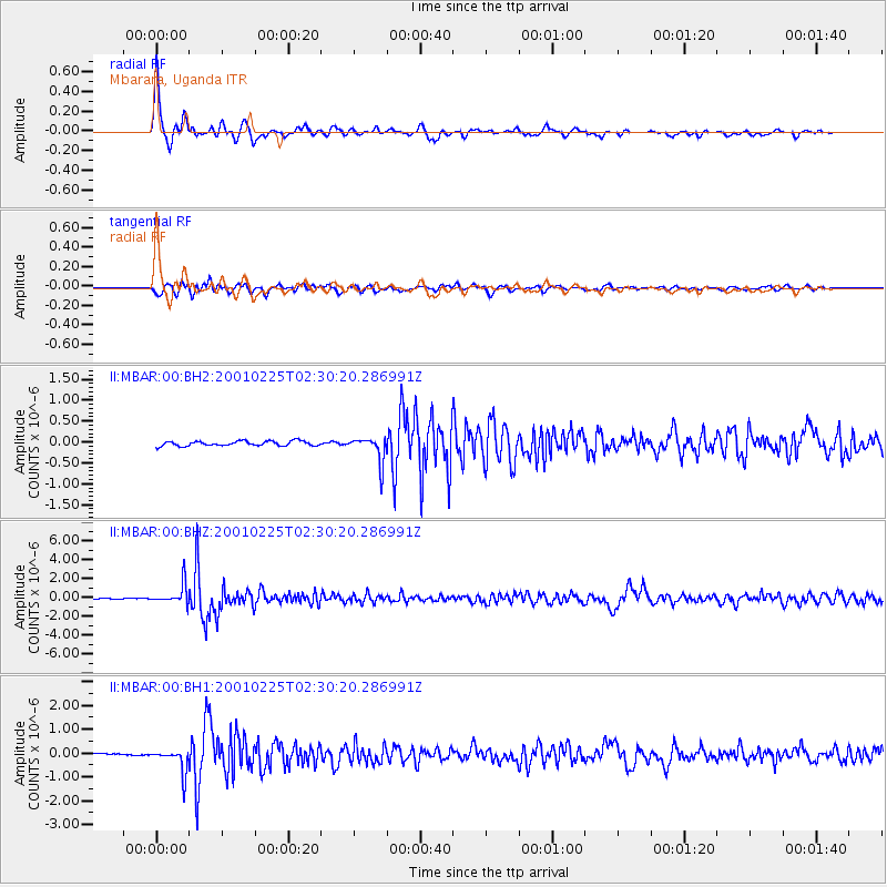
Signal To Noise
| Channel | StoN | STA | LTA |
| II:MBAR:00:BHZ:20010225T02:30:20.286991Z | 15.637351 | 1.0406732E-6 | 6.655048E-8 |
| II:MBAR:00:BH1:20010225T02:30:20.286991Z | 9.883185 | 4.898563E-7 | 4.9564616E-8 |
| II:MBAR:00:BH2:20010225T02:30:20.286991Z | 5.314326 | 3.0248688E-7 | 5.6919145E-8 |
| Arrivals |
| Ps | 4.4 SECOND |
| PpPs | 11 SECOND |
| PsPs/PpSs | 16 SECOND |


